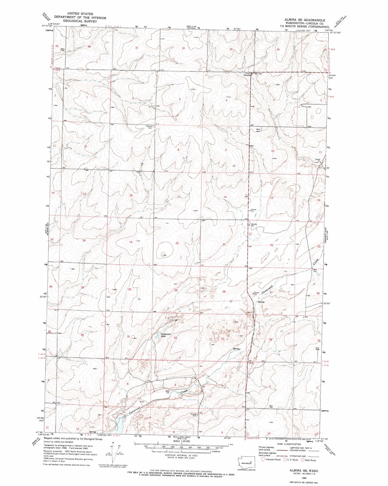
Almira Se Topo Map Washington
To zoom in, hover over the map of Almira Se
USGS Topo Quad 47118e7 - 1:24,000 scale
| Topo Map Name: | Almira Se |
| USGS Topo Quad ID: | 47118e7 |
| Print Size: | ca. 21 1/4" wide x 27" high |
| Southeast Coordinates: | 47.5° N latitude / 118.75° W longitude |
| Map Center Coordinates: | 47.5625° N latitude / 118.8125° W longitude |
| U.S. State: | WA |
| Filename: | o47118e7.jpg |
| Download Map JPG Image: | Almira Se topo map 1:24,000 scale |
| Map Type: | Topographic |
| Topo Series: | 7.5´ |
| Map Scale: | 1:24,000 |
| Source of Map Images: | United States Geological Survey (USGS) |
| Alternate Map Versions: |
Almira SE WA 1969, updated 1972 Download PDF Buy paper map Almira SE WA 2011 Download PDF Buy paper map Almira SE WA 2013 Download PDF Buy paper map |
1:24,000 Topo Quads surrounding Almira Se
Steamboat Rock East |
Jack Woods Butte |
Broadax Draw |
Wilbur |
Creston |
Hartline |
Almira |
Govan |
Wagner Lake |
Creston Butte |
Hartline Se |
Almira Sw |
Almira Se |
Draper Lake |
Swanson Lakes |
Wilson Creek |
Marlin |
Sullivan Lake |
Pacific Lake |
Coffeepot Lake |
Wilson Creek Se |
Marlin Sw |
Irby |
Odessa |
Sylvan Lake |
> Back to 47118e1 at 1:100,000 scale
> Back to 47118a1 at 1:250,000 scale
> Back to U.S. Topo Maps home
Almira Se digital topo map on disk
Buy this Almira Se topo map showing relief, roads, GPS coordinates and other geographical features, as a high-resolution digital map file on DVD: