Moses Lake South Topo Map Washington
To zoom in, hover over the map of Moses Lake South
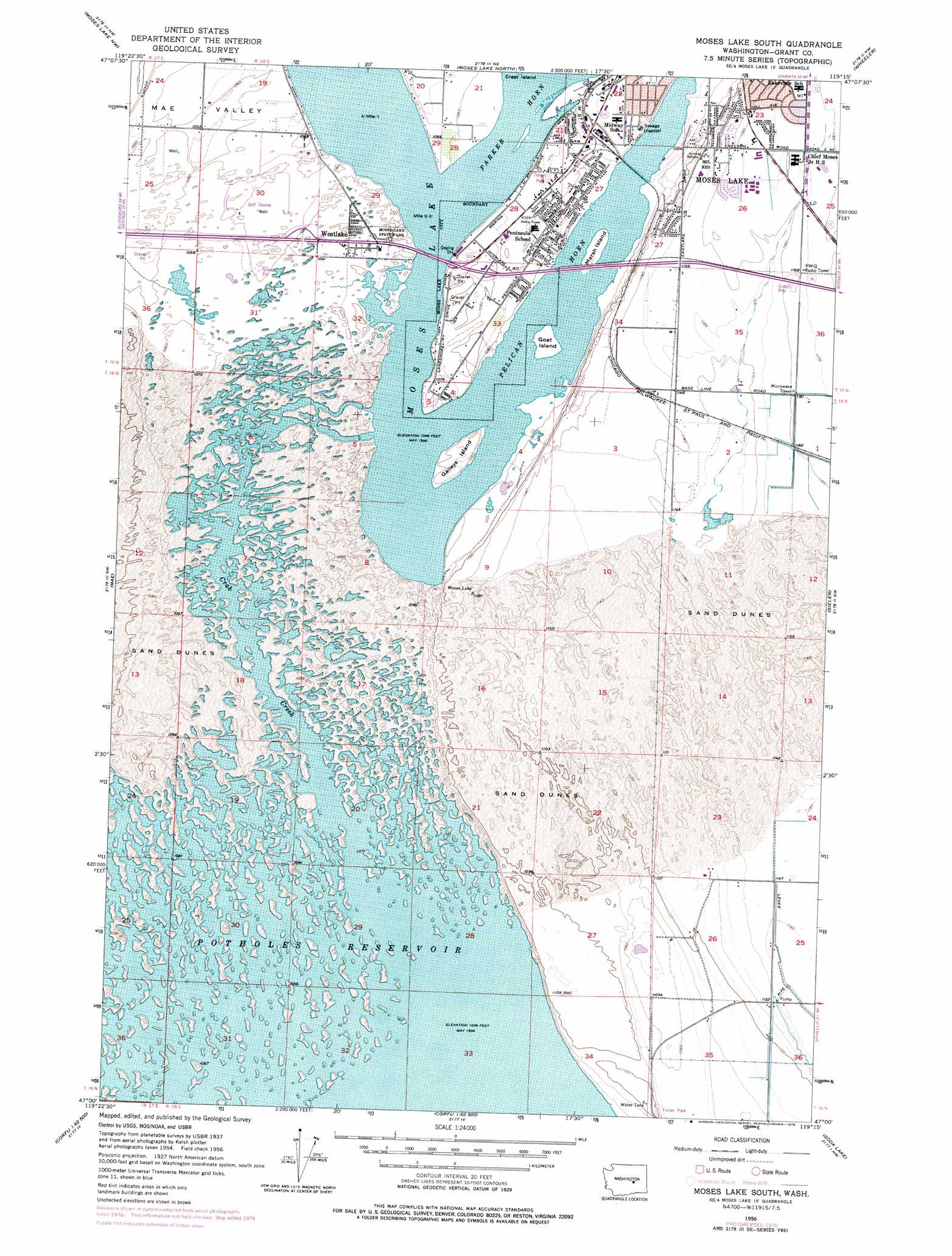
USGS Topo Quad 47119a3 - 1:24,000 scale
| Topo Map Name: | Moses Lake South |
| USGS Topo Quad ID: | 47119a3 |
| Print Size: | ca. 21 1/4" wide x 27" high |
| Southeast Coordinates: | 47° N latitude / 119.25° W longitude |
| Map Center Coordinates: | 47.0625° N latitude / 119.3125° W longitude |
| U.S. State: | WA |
| Filename: | o47119a3.jpg |
| Download Map JPG Image: | Moses Lake South topo map 1:24,000 scale |
| Map Type: | Topographic |
| Topo Series: | 7.5´ |
| Map Scale: | 1:24,000 |
| Source of Map Images: | United States Geological Survey (USGS) |
| Alternate Map Versions: |
Moses Lake South WA 1956, updated 1957 Download PDF Buy paper map Moses Lake South WA 1956, updated 1975 Download PDF Buy paper map Moses Lake South WA 1956, updated 1978 Download PDF Buy paper map Moses Lake South WA 2011 Download PDF Buy paper map Moses Lake South WA 2014 Download PDF Buy paper map |
1:24,000 Topo Quads surrounding Moses Lake South
Ephrata |
Grant Orchards |
Gloyd |
Wilson Creek Sw |
Wilson Creek Se |
Winchester Ne |
Moses Lake Nw |
Moses Lake North |
Wheeler |
Wheeler Ne |
Winchester Se |
Mae |
Moses Lake South |
Sieler |
Bassett Junction |
Frenchman Hills Lake |
Royal Camp |
O'Sullivan Dam |
Soda Lake |
Warden |
Wahatis Peak |
Corfu |
Taunton |
Othello |
Bruce |
> Back to 47119a1 at 1:100,000 scale
> Back to 47118a1 at 1:250,000 scale
> Back to U.S. Topo Maps home
Moses Lake South topo map: Gazetteer
Moses Lake South: Areas
No-Outlet Sand Hills elevation 346m 1135′Moses Lake South: Bays
Pelican Horn elevation 320m 1049′Moses Lake South: Dams
Moses Lake North Dam elevation 324m 1062′Moses Lake South Dam elevation 318m 1043′
Moses Lake South: Islands
Gaileys Island elevation 327m 1072′Goat Island elevation 320m 1049′
Marsh Island elevation 320m 1049′
Moses Lake South: Parks
Moses Lake State Park elevation 324m 1062′Potholes Habitat Management Area elevation 332m 1089′
Moses Lake South: Populated Places
Westlake elevation 324m 1062′Moses Lake South: Reservoirs
Moses Lake elevation 318m 1043′Moses Lake South: Streams
Crab Creek elevation 318m 1043′Moses Lake South digital topo map on disk
Buy this Moses Lake South topo map showing relief, roads, GPS coordinates and other geographical features, as a high-resolution digital map file on DVD: