Winchester Topo Map Washington
To zoom in, hover over the map of Winchester
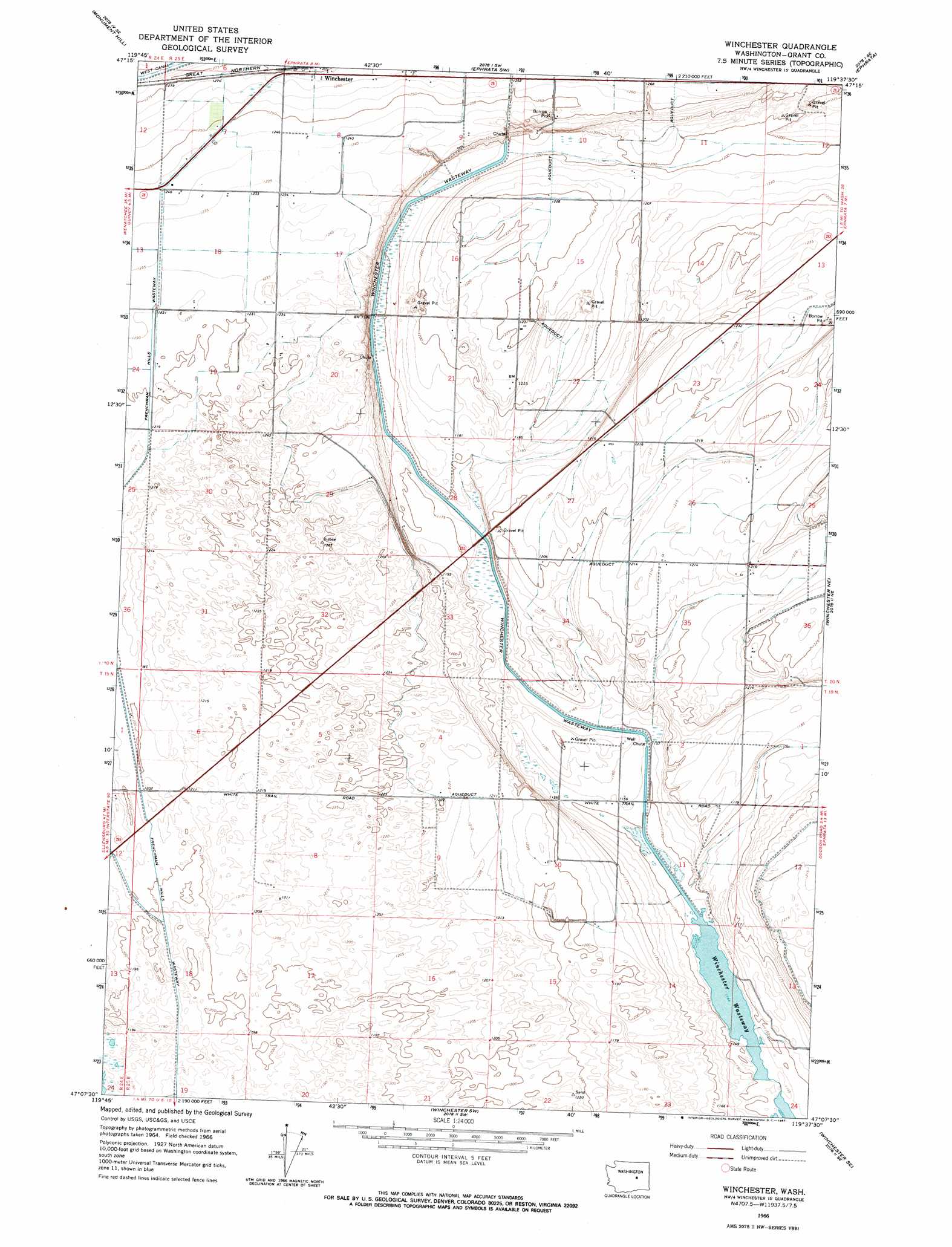
USGS Topo Quad 47119b6 - 1:24,000 scale
| Topo Map Name: | Winchester |
| USGS Topo Quad ID: | 47119b6 |
| Print Size: | ca. 21 1/4" wide x 27" high |
| Southeast Coordinates: | 47.125° N latitude / 119.625° W longitude |
| Map Center Coordinates: | 47.1875° N latitude / 119.6875° W longitude |
| U.S. State: | WA |
| Filename: | o47119b6.jpg |
| Download Map JPG Image: | Winchester topo map 1:24,000 scale |
| Map Type: | Topographic |
| Topo Series: | 7.5´ |
| Map Scale: | 1:24,000 |
| Source of Map Images: | United States Geological Survey (USGS) |
| Alternate Map Versions: |
Winchester WA 1966, updated 1967 Download PDF Buy paper map Winchester WA 2011 Download PDF Buy paper map Winchester WA 2014 Download PDF Buy paper map |
1:24,000 Topo Quads surrounding Winchester
Palisades |
Rattlesnake Springs |
Sagebrush Flat |
Little Soap Lake |
Soap Lake |
Appledale |
Monument Hill |
Ephrata Sw |
Ephrata |
Grant Orchards |
Babcock Ridge |
Quincy |
Winchester |
Winchester Ne |
Moses Lake Nw |
Evergreen Ridge |
George |
Winchester Sw |
Winchester Se |
Mae |
Vantage |
Beverly Ne |
Royal City |
Frenchman Hills Lake |
Royal Camp |
> Back to 47119a1 at 1:100,000 scale
> Back to 47118a1 at 1:250,000 scale
> Back to U.S. Topo Maps home
Winchester topo map: Gazetteer
Winchester: Airports
Grigg Farm Airport elevation 368m 1207′Winchester: Parks
North Columbia State Wildlife Recreation Area - Winchester Wasteway Unit elevation 350m 1148′Winchester: Populated Places
Winchester elevation 389m 1276′Winchester digital topo map on disk
Buy this Winchester topo map showing relief, roads, GPS coordinates and other geographical features, as a high-resolution digital map file on DVD: