Ephrata Topo Map Washington
To zoom in, hover over the map of Ephrata
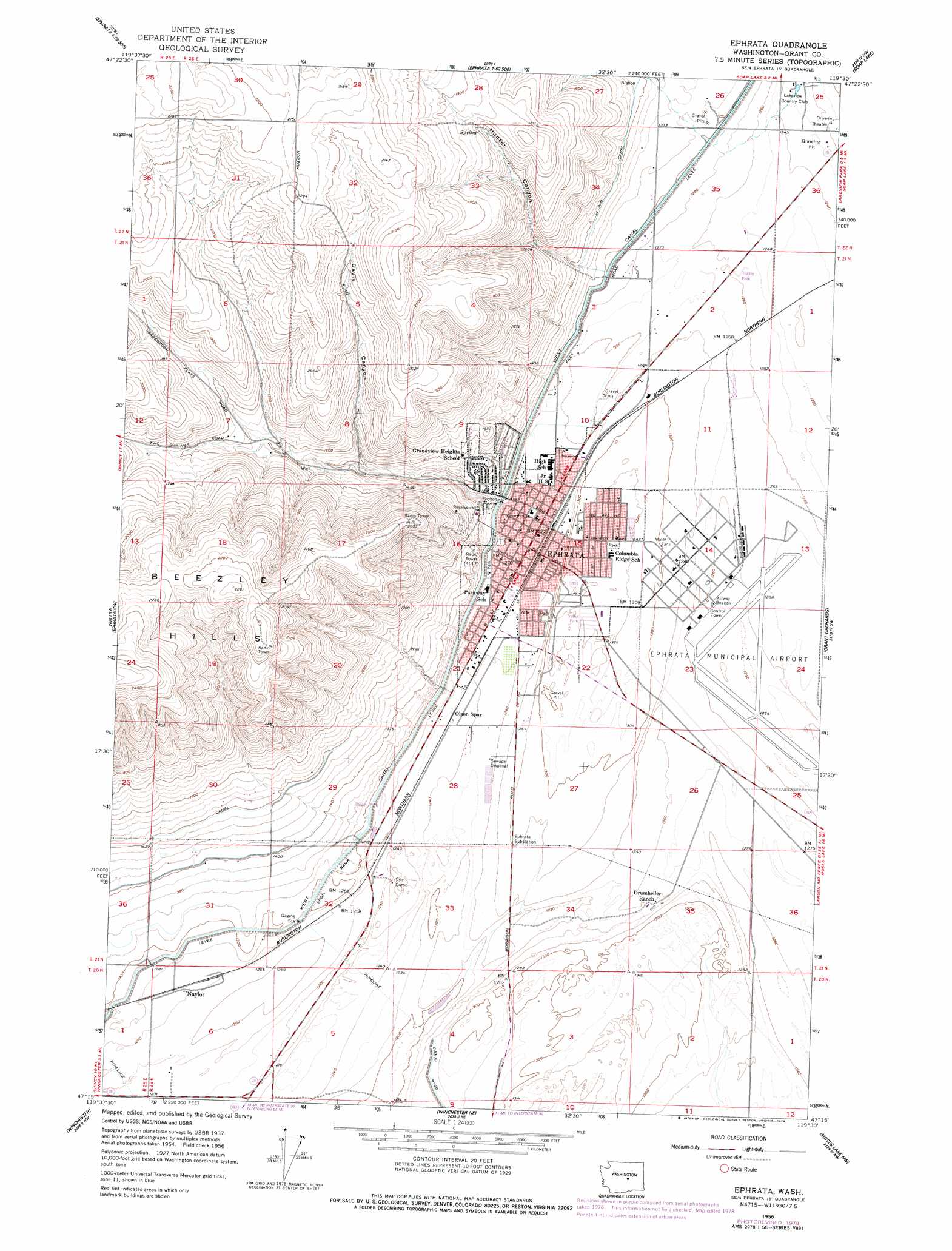
USGS Topo Quad 47119c5 - 1:24,000 scale
| Topo Map Name: | Ephrata |
| USGS Topo Quad ID: | 47119c5 |
| Print Size: | ca. 21 1/4" wide x 27" high |
| Southeast Coordinates: | 47.25° N latitude / 119.5° W longitude |
| Map Center Coordinates: | 47.3125° N latitude / 119.5625° W longitude |
| U.S. State: | WA |
| Filename: | o47119c5.jpg |
| Download Map JPG Image: | Ephrata topo map 1:24,000 scale |
| Map Type: | Topographic |
| Topo Series: | 7.5´ |
| Map Scale: | 1:24,000 |
| Source of Map Images: | United States Geological Survey (USGS) |
| Alternate Map Versions: |
Ephrata WA 1956, updated 1957 Download PDF Buy paper map Ephrata WA 1956, updated 1966 Download PDF Buy paper map Ephrata WA 1956, updated 1978 Download PDF Buy paper map Ephrata WA 2011 Download PDF Buy paper map Ephrata WA 2014 Download PDF Buy paper map |
1:24,000 Topo Quads surrounding Ephrata
Farmer |
Jameson Lake Sw |
Jameson Lake Se |
Park Lake |
Coulee City |
Rattlesnake Springs |
Sagebrush Flat |
Little Soap Lake |
Soap Lake |
Stratford |
Monument Hill |
Ephrata Sw |
Ephrata |
Grant Orchards |
Gloyd |
Quincy |
Winchester |
Winchester Ne |
Moses Lake Nw |
Moses Lake North |
George |
Winchester Sw |
Winchester Se |
Mae |
Moses Lake South |
> Back to 47119a1 at 1:100,000 scale
> Back to 47118a1 at 1:250,000 scale
> Back to U.S. Topo Maps home
Ephrata topo map: Gazetteer
Ephrata: Airports
Columbia Basin Hospital Heliport elevation 401m 1315′Ephrata Municipal Airport elevation 383m 1256′
Ephrata: Basins
The Pot Hole elevation 363m 1190′Ephrata: Parks
Ephrata Heights Park elevation 404m 1325′Oasis Park elevation 392m 1286′
Parkway Park elevation 404m 1325′
Ephrata: Populated Places
Ephrata elevation 389m 1276′Lakeview elevation 367m 1204′
Naylor elevation 387m 1269′
Ephrata: Valleys
Davis Canyon elevation 452m 1482′Hunter Canyon elevation 420m 1377′
Ephrata digital topo map on disk
Buy this Ephrata topo map showing relief, roads, GPS coordinates and other geographical features, as a high-resolution digital map file on DVD: