Appledale Topo Map Washington
To zoom in, hover over the map of Appledale
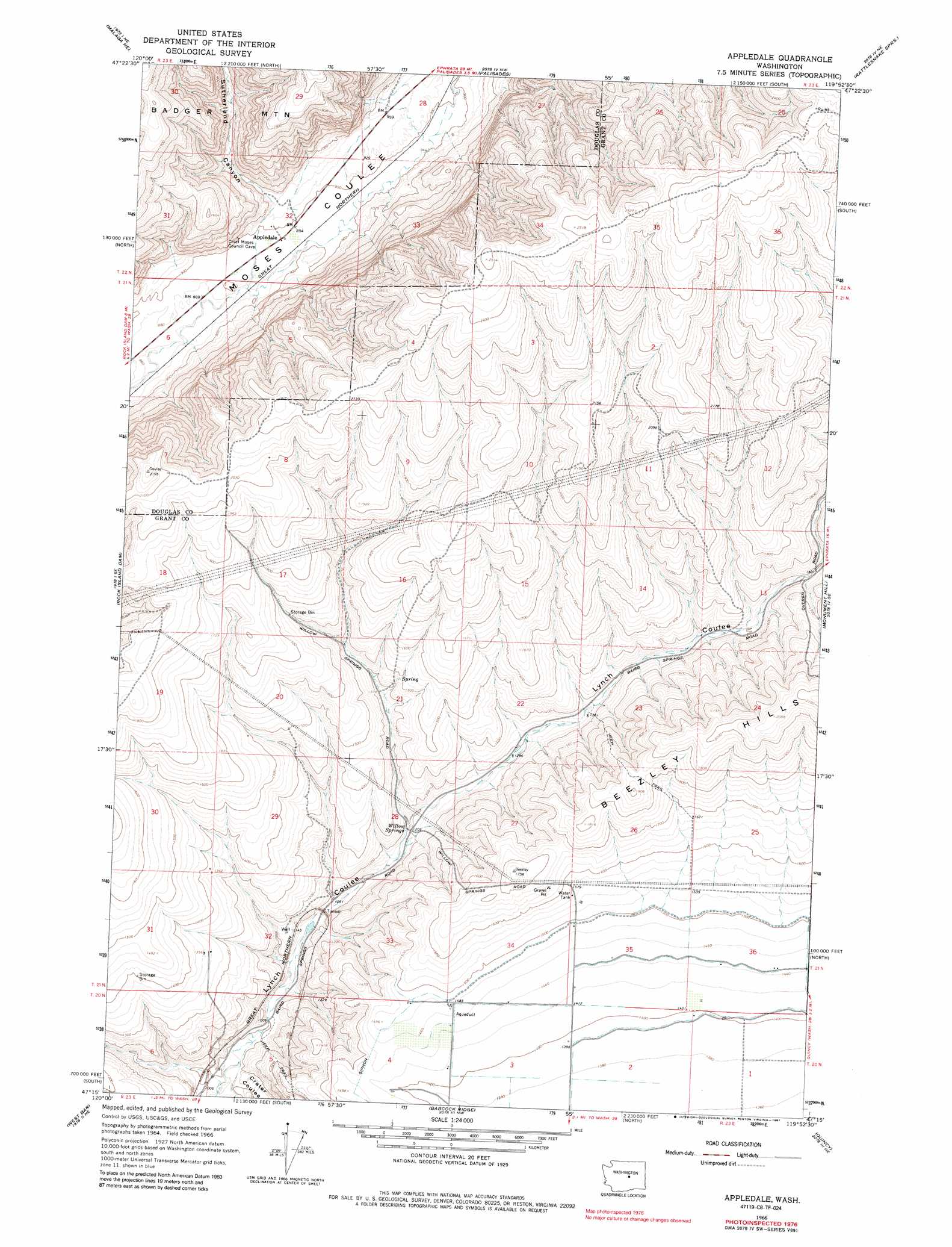
USGS Topo Quad 47119c8 - 1:24,000 scale
| Topo Map Name: | Appledale |
| USGS Topo Quad ID: | 47119c8 |
| Print Size: | ca. 21 1/4" wide x 27" high |
| Southeast Coordinates: | 47.25° N latitude / 119.875° W longitude |
| Map Center Coordinates: | 47.3125° N latitude / 119.9375° W longitude |
| U.S. State: | WA |
| Filename: | o47119c8.jpg |
| Download Map JPG Image: | Appledale topo map 1:24,000 scale |
| Map Type: | Topographic |
| Topo Series: | 7.5´ |
| Map Scale: | 1:24,000 |
| Source of Map Images: | United States Geological Survey (USGS) |
| Alternate Map Versions: |
Appledale WA 1966, updated 1968 Download PDF Buy paper map Appledale WA 1966, updated 1987 Download PDF Buy paper map Appledale WA 2011 Download PDF Buy paper map Appledale WA 2014 Download PDF Buy paper map |
1:24,000 Topo Quads surrounding Appledale
Orondo |
Douglas |
Alstown |
Farmer |
Jameson Lake Sw |
Rock Island |
Malaga Ne |
Palisades |
Rattlesnake Springs |
Sagebrush Flat |
Malaga |
Rock Island Dam |
Appledale |
Monument Hill |
Ephrata Sw |
Stray Gulch |
West Bar |
Babcock Ridge |
Quincy |
Winchester |
Whiskey Dick Mountain |
Cape Horn Se |
Evergreen Ridge |
George |
Winchester Sw |
> Back to 47119a1 at 1:100,000 scale
> Back to 47118a1 at 1:250,000 scale
> Back to U.S. Topo Maps home
Appledale topo map: Gazetteer
Appledale: Populated Places
Appledale elevation 273m 895′Appledale: Springs
Baird Springs elevation 491m 1610′Willow Springs elevation 367m 1204′
Appledale: Valleys
Crater Coulee elevation 300m 984′Sutherland Canyon elevation 286m 938′
Appledale digital topo map on disk
Buy this Appledale topo map showing relief, roads, GPS coordinates and other geographical features, as a high-resolution digital map file on DVD: