Jameson Lake East Topo Map Washington
To zoom in, hover over the map of Jameson Lake East
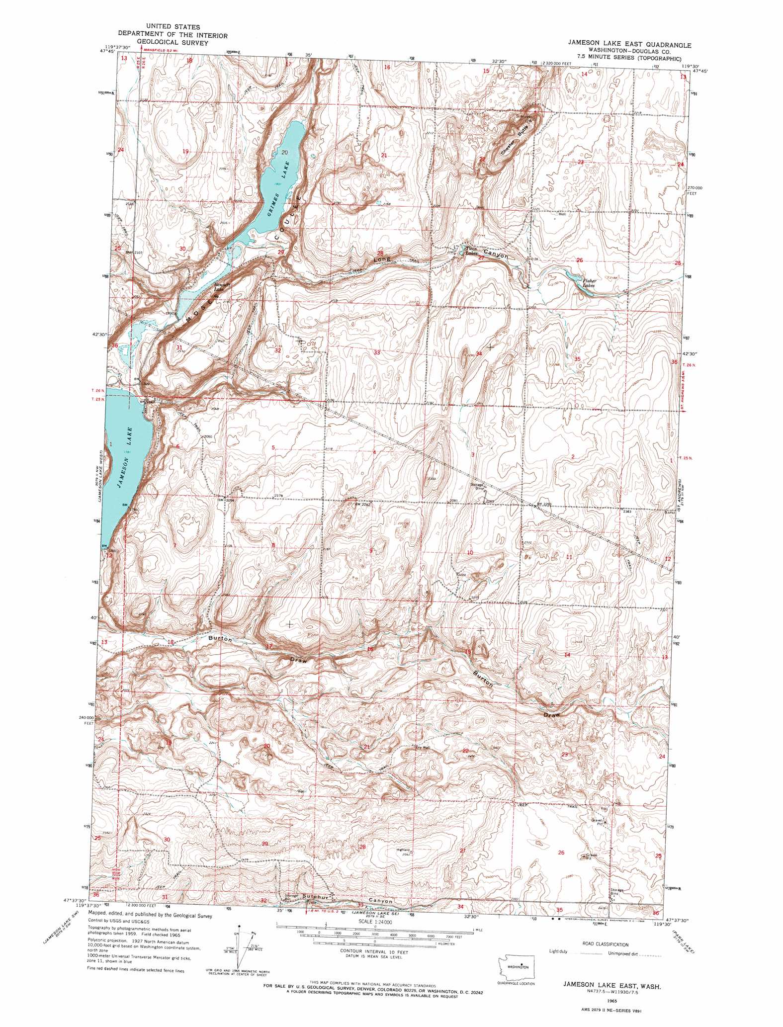
USGS Topo Quad 47119f5 - 1:24,000 scale
| Topo Map Name: | Jameson Lake East |
| USGS Topo Quad ID: | 47119f5 |
| Print Size: | ca. 21 1/4" wide x 27" high |
| Southeast Coordinates: | 47.625° N latitude / 119.5° W longitude |
| Map Center Coordinates: | 47.6875° N latitude / 119.5625° W longitude |
| U.S. State: | WA |
| Filename: | o47119f5.jpg |
| Download Map JPG Image: | Jameson Lake East topo map 1:24,000 scale |
| Map Type: | Topographic |
| Topo Series: | 7.5´ |
| Map Scale: | 1:24,000 |
| Source of Map Images: | United States Geological Survey (USGS) |
| Alternate Map Versions: |
Jameson Lake East WA 1965, updated 1966 Download PDF Buy paper map Jameson Lake East WA 2011 Download PDF Buy paper map Jameson Lake East WA 2014 Download PDF Buy paper map |
1:24,000 Topo Quads surrounding Jameson Lake East
Wells Dam |
Chief Joseph Dam |
Coleman Hill |
Leahy |
Foster Coulee |
Mud Spring |
Mansfield |
Piersol Hills |
Barnes Butte |
Sims Corner |
Withrow |
Jameson Lake West |
Jameson Lake East |
Saint Andrews |
Mold |
Farmer |
Jameson Lake Sw |
Jameson Lake Se |
Park Lake |
Coulee City |
Rattlesnake Springs |
Sagebrush Flat |
Little Soap Lake |
Soap Lake |
Stratford |
> Back to 47119e1 at 1:100,000 scale
> Back to 47118a1 at 1:250,000 scale
> Back to U.S. Topo Maps home
Jameson Lake East topo map: Gazetteer
Jameson Lake East: Lakes
Bennett Lake elevation 557m 1827′Fisher Lakes elevation 654m 2145′
Grimes Lake elevation 559m 1833′
Jameson Lake elevation 544m 1784′
Twin Lakes elevation 640m 2099′
Jameson Lake East: Summits
Chester Butte elevation 712m 2335′Jameson Lake East: Valleys
Long Canyon elevation 559m 1833′Jameson Lake East digital topo map on disk
Buy this Jameson Lake East topo map showing relief, roads, GPS coordinates and other geographical features, as a high-resolution digital map file on DVD: