Steamboat Rock West Topo Map Washington
To zoom in, hover over the map of Steamboat Rock West
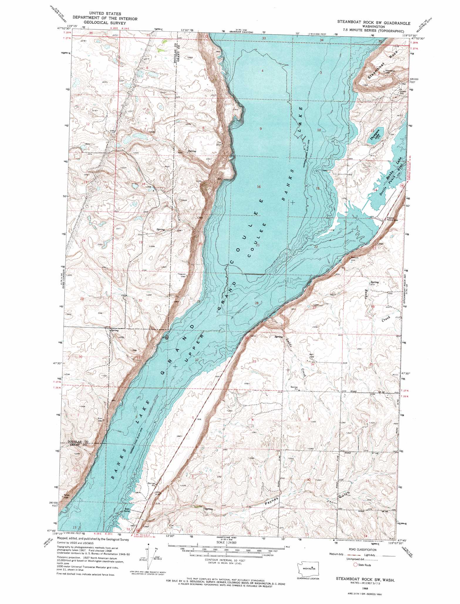
USGS Topo Quad 47119g2 - 1:24,000 scale
| Topo Map Name: | Steamboat Rock West |
| USGS Topo Quad ID: | 47119g2 |
| Print Size: | ca. 21 1/4" wide x 27" high |
| Southeast Coordinates: | 47.75° N latitude / 119.125° W longitude |
| Map Center Coordinates: | 47.8125° N latitude / 119.1875° W longitude |
| U.S. State: | WA |
| Filename: | o47119g2.jpg |
| Download Map JPG Image: | Steamboat Rock West topo map 1:24,000 scale |
| Map Type: | Topographic |
| Topo Series: | 7.5´ |
| Map Scale: | 1:24,000 |
| Source of Map Images: | United States Geological Survey (USGS) |
| Alternate Map Versions: |
Steamboat Rock SW WA 1968, updated 1971 Download PDF Buy paper map Steamboat Rock SW WA 2011 Download PDF Buy paper map Steamboat Rock SW WA 2014 Download PDF Buy paper map |
1:24,000 Topo Quads surrounding Steamboat Rock West
Stubblefield Point |
Trefry Canyon |
Alameda Flat |
Sanderson Creek |
Belvedere |
Leahy |
Foster Coulee |
Barker Canyon |
Electric City |
Grand Coulee Dam |
Barnes Butte |
Sims Corner |
Steamboat Rock West |
Steamboat Rock East |
Jack Woods Butte |
Saint Andrews |
Mold |
Hartline Nw |
Hartline |
Almira |
Park Lake |
Coulee City |
Hartline Sw |
Hartline Se |
Almira Sw |
> Back to 47119e1 at 1:100,000 scale
> Back to 47118a1 at 1:250,000 scale
> Back to U.S. Topo Maps home
Steamboat Rock West topo map: Gazetteer
Steamboat Rock West: Dams
Higginbotham Reservoir Dam elevation 705m 2312′Steamboat Rock West: Lakes
Thompson Lake elevation 480m 1574′Steamboat Rock West: Parks
Banks Lake Wildlife Recreation Area elevation 486m 1594′Steamboat Rock State Park elevation 602m 1975′
Steamboat Rock West: Reservoirs
Higginbotham Reservoir elevation 705m 2312′Steamboat Rock West: Streams
Ladds Creek elevation 480m 1574′Lower Lewis Creek elevation 480m 1574′
Rusho Creek elevation 485m 1591′
Steamboat Rock West: Summits
Steamboat Rock elevation 696m 2283′Steamboat Rock West: Valleys
Paynes Gulch elevation 484m 1587′Steamboat Rock West digital topo map on disk
Buy this Steamboat Rock West topo map showing relief, roads, GPS coordinates and other geographical features, as a high-resolution digital map file on DVD: