Mud Spring Topo Map Washington
To zoom in, hover over the map of Mud Spring
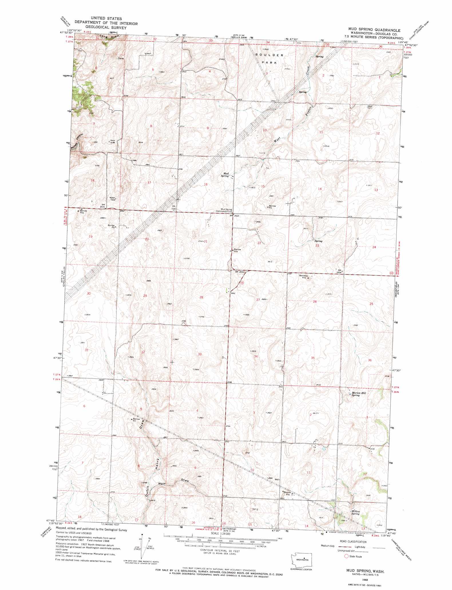
USGS Topo Quad 47119g7 - 1:24,000 scale
| Topo Map Name: | Mud Spring |
| USGS Topo Quad ID: | 47119g7 |
| Print Size: | ca. 21 1/4" wide x 27" high |
| Southeast Coordinates: | 47.75° N latitude / 119.75° W longitude |
| Map Center Coordinates: | 47.8125° N latitude / 119.8125° W longitude |
| U.S. State: | WA |
| Filename: | o47119g7.jpg |
| Download Map JPG Image: | Mud Spring topo map 1:24,000 scale |
| Map Type: | Topographic |
| Topo Series: | 7.5´ |
| Map Scale: | 1:24,000 |
| Source of Map Images: | United States Geological Survey (USGS) |
| Alternate Map Versions: |
Mud Spring WA 1968, updated 1971 Download PDF Buy paper map Mud Spring WA 2011 Download PDF Buy paper map Mud Spring WA 2014 Download PDF Buy paper map |
1:24,000 Topo Quads surrounding Mud Spring
Cooper Mountain |
Pateros |
Brewster |
Bridgeport |
Bridgeport Point |
Cooper Ridge |
Azwell |
Wells Dam |
Chief Joseph Dam |
Coleman Hill |
Chelan |
Chelan Falls |
Mud Spring |
Mansfield |
Piersol Hills |
Waterville |
Lamoine |
Withrow |
Jameson Lake West |
Jameson Lake East |
Douglas |
Alstown |
Farmer |
Jameson Lake Sw |
Jameson Lake Se |
> Back to 47119e1 at 1:100,000 scale
> Back to 47118a1 at 1:250,000 scale
> Back to U.S. Topo Maps home
Mud Spring topo map: Gazetteer
Mud Spring: Populated Places
Mud Spring elevation 800m 2624′Mud Spring: Springs
Marion Hill Spring elevation 769m 2522′Mud Spring elevation 800m 2624′
Willow Spring elevation 769m 2522′
Mud Spring: Valleys
Wolf Draw elevation 817m 2680′Mud Spring digital topo map on disk
Buy this Mud Spring topo map showing relief, roads, GPS coordinates and other geographical features, as a high-resolution digital map file on DVD: