Coleman Hill Topo Map Washington
To zoom in, hover over the map of Coleman Hill
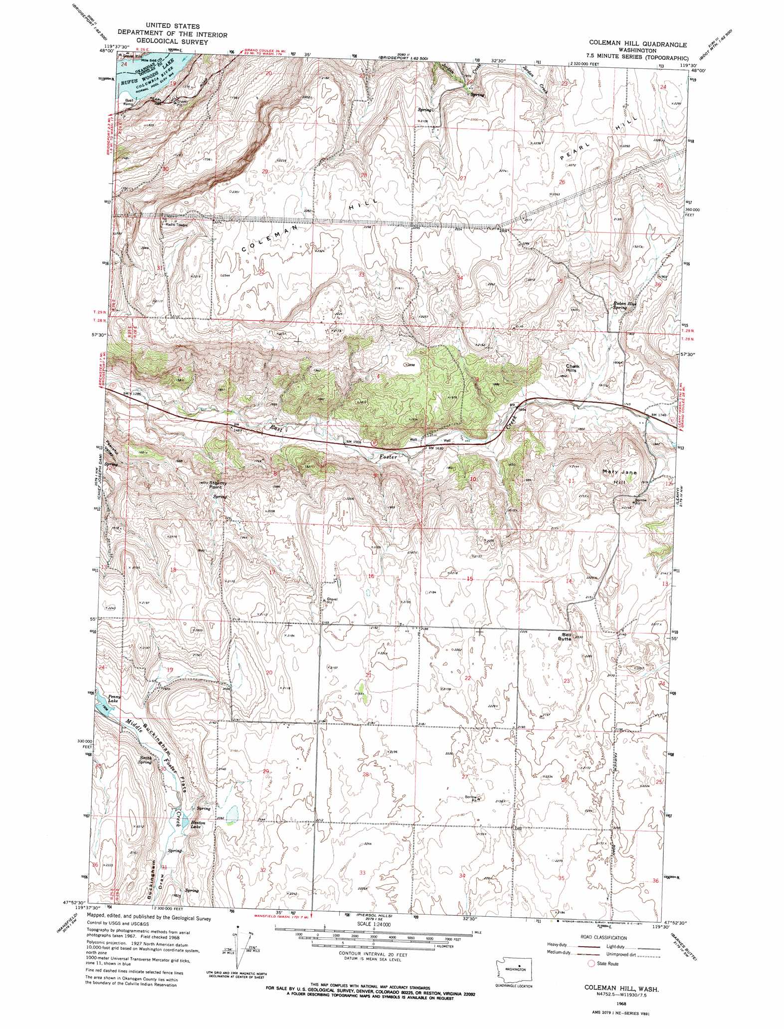
USGS Topo Quad 47119h5 - 1:24,000 scale
| Topo Map Name: | Coleman Hill |
| USGS Topo Quad ID: | 47119h5 |
| Print Size: | ca. 21 1/4" wide x 27" high |
| Southeast Coordinates: | 47.875° N latitude / 119.5° W longitude |
| Map Center Coordinates: | 47.9375° N latitude / 119.5625° W longitude |
| U.S. State: | WA |
| Filename: | o47119h5.jpg |
| Download Map JPG Image: | Coleman Hill topo map 1:24,000 scale |
| Map Type: | Topographic |
| Topo Series: | 7.5´ |
| Map Scale: | 1:24,000 |
| Source of Map Images: | United States Geological Survey (USGS) |
| Alternate Map Versions: |
Coleman Hill WA 1968, updated 1971 Download PDF Buy paper map Coleman Hill WA 2011 Download PDF Buy paper map Coleman Hill WA 2014 Download PDF Buy paper map |
1:24,000 Topo Quads surrounding Coleman Hill
Rat Lake |
Monse |
White Lakes |
Joe Lake |
Boot Mountain |
Brewster |
Bridgeport |
Bridgeport Point |
Stubblefield Point |
Trefry Canyon |
Wells Dam |
Chief Joseph Dam |
Coleman Hill |
Leahy |
Foster Coulee |
Mud Spring |
Mansfield |
Piersol Hills |
Barnes Butte |
Sims Corner |
Withrow |
Jameson Lake West |
Jameson Lake East |
Saint Andrews |
Mold |
> Back to 47119e1 at 1:100,000 scale
> Back to 47118a1 at 1:250,000 scale
> Back to U.S. Topo Maps home
Coleman Hill topo map: Gazetteer
Coleman Hill: Capes
Stormy Point elevation 567m 1860′Coleman Hill: Lakes
Henton Lake elevation 581m 1906′Penny Lake elevation 580m 1902′
Coleman Hill: Ranges
Coleman Hill elevation 712m 2335′Coleman Hill: Springs
Ruben Blue Spring elevation 556m 1824′Smith Spring elevation 597m 1958′
Coleman Hill: Summits
Bell Butte elevation 701m 2299′Chalk Hills elevation 555m 1820′
Mary Jane Hill elevation 639m 2096′
Coleman Hill: Valleys
Buckingham Draw elevation 586m 1922′Coleman Hill digital topo map on disk
Buy this Coleman Hill topo map showing relief, roads, GPS coordinates and other geographical features, as a high-resolution digital map file on DVD: