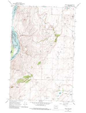
Wells Dam Topo Map Washington
To zoom in, hover over the map of Wells Dam
USGS Topo Quad 47119h7 - 1:24,000 scale
| Topo Map Name: | Wells Dam |
| USGS Topo Quad ID: | 47119h7 |
| Print Size: | ca. 21 1/4" wide x 27" high |
| Southeast Coordinates: | 47.875° N latitude / 119.75° W longitude |
| Map Center Coordinates: | 47.9375° N latitude / 119.8125° W longitude |
| U.S. State: | WA |
| Filename: | o47119h7.jpg |
| Download Map JPG Image: | Wells Dam topo map 1:24,000 scale |
| Map Type: | Topographic |
| Topo Series: | 7.5´ |
| Map Scale: | 1:24,000 |
| Source of Map Images: | United States Geological Survey (USGS) |
| Alternate Map Versions: |
Wells Dam WA 1968, updated 1971 Download PDF Buy paper map Wells Dam WA 1968, updated 1981 Download PDF Buy paper map Wells Dam WA 2011 Download PDF Buy paper map Wells Dam WA 2014 Download PDF Buy paper map |
1:24,000 Topo Quads surrounding Wells Dam
> Back to 47119e1 at 1:100,000 scale
> Back to 47118a1 at 1:250,000 scale
> Back to U.S. Topo Maps home
Wells Dam topo map: Gazetteer
Wells Dam: Basins
Cold Springs Basin elevation 731m 2398′Wells Dam: Dams
Wells Dam elevation 239m 784′Wells Dam: Flats
Bonita Flats elevation 277m 908′Boulder Park elevation 793m 2601′
Sourdough Flats elevation 761m 2496′
The Horseshoe elevation 816m 2677′
Wells Dam: Lakes
Alexander Lake elevation 846m 2775′Beard Lake elevation 694m 2276′
Cornehl Lake elevation 705m 2312′
Dezellem Lake elevation 820m 2690′
Wells Dam: Populated Places
Dyer elevation 833m 2732′Howard elevation 855m 2805′
Wells Dam: Reservoirs
Lake Pateros elevation 239m 784′Wells Dam: Springs
Downey Spring elevation 710m 2329′Ford Spring elevation 535m 1755′
Pattie Big Spring elevation 734m 2408′
Wells Dam: Summits
Dyer Hill elevation 891m 2923′Landingham Hill elevation 875m 2870′
Windsor Hill elevation 814m 2670′
Wells Dam: Valleys
Skeleton Canyon elevation 218m 715′Wells Dam digital topo map on disk
Buy this Wells Dam topo map showing relief, roads, GPS coordinates and other geographical features, as a high-resolution digital map file on DVD:


