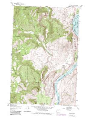
Azwell Topo Map Washington
To zoom in, hover over the map of Azwell
USGS Topo Quad 47119h8 - 1:24,000 scale
| Topo Map Name: | Azwell |
| USGS Topo Quad ID: | 47119h8 |
| Print Size: | ca. 21 1/4" wide x 27" high |
| Southeast Coordinates: | 47.875° N latitude / 119.875° W longitude |
| Map Center Coordinates: | 47.9375° N latitude / 119.9375° W longitude |
| U.S. State: | WA |
| Filename: | o47119h8.jpg |
| Download Map JPG Image: | Azwell topo map 1:24,000 scale |
| Map Type: | Topographic |
| Topo Series: | 7.5´ |
| Map Scale: | 1:24,000 |
| Source of Map Images: | United States Geological Survey (USGS) |
| Alternate Map Versions: |
Azwell WA 1968, updated 1971 Download PDF Buy paper map Azwell WA 1968, updated 1981 Download PDF Buy paper map Azwell WA 1968, updated 1987 Download PDF Buy paper map Azwell WA 2001, updated 2004 Download PDF Buy paper map Azwell WA 2011 Download PDF Buy paper map Azwell WA 2014 Download PDF Buy paper map |
| FStopo: | US Forest Service topo Azwell is available: Download FStopo PDF Download FStopo TIF |
1:24,000 Topo Quads surrounding Azwell
> Back to 47119e1 at 1:100,000 scale
> Back to 47118a1 at 1:250,000 scale
> Back to U.S. Topo Maps home
Azwell topo map: Gazetteer
Azwell: Benches
Highland Bench elevation 595m 1952′Azwell: Flats
Gossman Flats elevation 384m 1259′Washington Flat elevation 730m 2395′
Azwell: Lakes
Green Lake elevation 391m 1282′Little Dick Lake elevation 583m 1912′
Azwell: Parks
Ice Caves State Park (historical) elevation 485m 1591′Azwell: Populated Places
Azwell elevation 238m 780′Starr elevation 249m 816′
Azwell: Springs
Bonnie Merrit Spring elevation 1108m 3635′Den Williams Spring elevation 641m 2103′
Azwell: Streams
Antoine Creek elevation 217m 711′Washington Creek elevation 392m 1286′
Azwell: Summits
Arbuckle Mountain elevation 907m 2975′Azwell: Valleys
Bigelow Canyon elevation 419m 1374′Brownfield Canyon elevation 426m 1397′
Long Draw elevation 222m 728′
Spray Canyon elevation 599m 1965′
Union Valley elevation 563m 1847′
Wadams Canyon elevation 733m 2404′
Azwell digital topo map on disk
Buy this Azwell topo map showing relief, roads, GPS coordinates and other geographical features, as a high-resolution digital map file on DVD:


