Colockum Pass Se Topo Map Washington
To zoom in, hover over the map of Colockum Pass Se
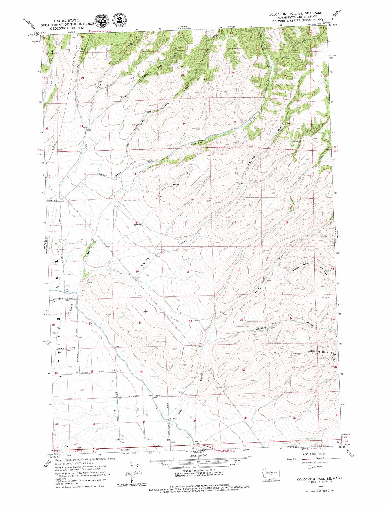
USGS Topo Quad 47120a3 - 1:24,000 scale
| Topo Map Name: | Colockum Pass Se |
| USGS Topo Quad ID: | 47120a3 |
| Print Size: | ca. 21 1/4" wide x 27" high |
| Southeast Coordinates: | 47° N latitude / 120.25° W longitude |
| Map Center Coordinates: | 47.0625° N latitude / 120.3125° W longitude |
| U.S. State: | WA |
| Filename: | o47120a3.jpg |
| Download Map JPG Image: | Colockum Pass Se topo map 1:24,000 scale |
| Map Type: | Topographic |
| Topo Series: | 7.5´ |
| Map Scale: | 1:24,000 |
| Source of Map Images: | United States Geological Survey (USGS) |
| Alternate Map Versions: |
Colockum Pass SE WA 1966, updated 1967 Download PDF Buy paper map Colockum Pass SE WA 2011 Download PDF Buy paper map Colockum Pass SE WA 2014 Download PDF Buy paper map |
1:24,000 Topo Quads surrounding Colockum Pass Se
Swauk Pass |
Mission Peak |
Wenatchee Heights |
Malaga |
Rock Island Dam |
Reecer Canyon |
Naneum Canyon |
Colockum Pass |
Stray Gulch |
West Bar |
Ellensburg North |
Colockum Pass Sw |
Colockum Pass Se |
Whiskey Dick Mountain |
Cape Horn Se |
Ellensburg South |
Kittitas |
East Kittitas |
Boylston |
Ginkgo |
The Cottonwoods |
Wymer |
Badger Gap |
Mcdonald Spring |
Doris |
> Back to 47120a1 at 1:100,000 scale
> Back to 47120a1 at 1:250,000 scale
> Back to U.S. Topo Maps home
Colockum Pass Se topo map: Gazetteer
Colockum Pass Se: Canals
North Branch Canal elevation 627m 2057′Colockum Pass Se: Streams
Little Caribou Creek elevation 750m 2460′Sheep Creek elevation 797m 2614′
Whiskey Jim Creek elevation 689m 2260′
Colockum Pass Se: Summits
Chinamans Hat elevation 1127m 3697′Colockum Pass Se: Valleys
Black Rock Canyon elevation 794m 2604′Spring Gulch elevation 643m 2109′
Colockum Pass Se digital topo map on disk
Buy this Colockum Pass Se topo map showing relief, roads, GPS coordinates and other geographical features, as a high-resolution digital map file on DVD: