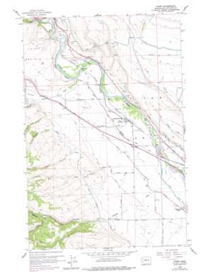
Thorp Topo Map Washington
To zoom in, hover over the map of Thorp
USGS Topo Quad 47120a6 - 1:24,000 scale
| Topo Map Name: | Thorp |
| USGS Topo Quad ID: | 47120a6 |
| Print Size: | ca. 21 1/4" wide x 27" high |
| Southeast Coordinates: | 47° N latitude / 120.625° W longitude |
| Map Center Coordinates: | 47.0625° N latitude / 120.6875° W longitude |
| U.S. State: | WA |
| Filename: | o47120a6.jpg |
| Download Map JPG Image: | Thorp topo map 1:24,000 scale |
| Map Type: | Topographic |
| Topo Series: | 7.5´ |
| Map Scale: | 1:24,000 |
| Source of Map Images: | United States Geological Survey (USGS) |
| Alternate Map Versions: |
Thorp WA 1958, updated 1960 Download PDF Buy paper map Thorp WA 1958, updated 1964 Download PDF Buy paper map Thorp WA 2011 Download PDF Buy paper map Thorp WA 2014 Download PDF Buy paper map |
1:24,000 Topo Quads surrounding Thorp
> Back to 47120a1 at 1:100,000 scale
> Back to 47120a1 at 1:250,000 scale
> Back to U.S. Topo Maps home
Thorp topo map: Gazetteer
Thorp: Canals
Ellensburg Power Canal elevation 487m 1597′South Branch Canal elevation 633m 2076′
Taneum Ditch elevation 560m 1837′
West Side Canal elevation 501m 1643′
Thorp: Populated Places
Thorp elevation 499m 1637′Thorp: Streams
Robinson Creek elevation 489m 1604′Swauk Creek elevation 536m 1758′
Taneum Creek elevation 516m 1692′
Thorp: Valleys
Ainsley Canyon elevation 806m 2644′North Winegar Canyon elevation 793m 2601′
Page Canyon elevation 547m 1794′
Rattlesnake Canyon elevation 588m 1929′
Robinson Canyon elevation 628m 2060′
South Winegar Canyon elevation 793m 2601′
Taneum Canyon elevation 549m 1801′
Wagner Canyon elevation 596m 1955′
Watt Canyon elevation 638m 2093′
Winegar Canyon elevation 609m 1998′
Thorp digital topo map on disk
Buy this Thorp topo map showing relief, roads, GPS coordinates and other geographical features, as a high-resolution digital map file on DVD:


