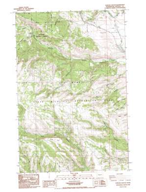
Taneum Canyon Topo Map Washington
To zoom in, hover over the map of Taneum Canyon
USGS Topo Quad 47120a7 - 1:24,000 scale
| Topo Map Name: | Taneum Canyon |
| USGS Topo Quad ID: | 47120a7 |
| Print Size: | ca. 21 1/4" wide x 27" high |
| Southeast Coordinates: | 47° N latitude / 120.75° W longitude |
| Map Center Coordinates: | 47.0625° N latitude / 120.8125° W longitude |
| U.S. State: | WA |
| Filename: | o47120a7.jpg |
| Download Map JPG Image: | Taneum Canyon topo map 1:24,000 scale |
| Map Type: | Topographic |
| Topo Series: | 7.5´ |
| Map Scale: | 1:24,000 |
| Source of Map Images: | United States Geological Survey (USGS) |
| Alternate Map Versions: |
Taneum Canyon WA 1985, updated 1985 Download PDF Buy paper map Taneum Canyon WA 1985, updated 1985 Download PDF Buy paper map Taneum Canyon WA 2003, updated 2006 Download PDF Buy paper map Taneum Canyon WA 2011 Download PDF Buy paper map Taneum Canyon WA 2014 Download PDF Buy paper map |
| FStopo: | US Forest Service topo Taneum Canyon is available: Download FStopo PDF Download FStopo TIF |
1:24,000 Topo Quads surrounding Taneum Canyon
> Back to 47120a1 at 1:100,000 scale
> Back to 47120a1 at 1:250,000 scale
> Back to U.S. Topo Maps home
Taneum Canyon topo map: Gazetteer
Taneum Canyon: Canals
Newman Siphon elevation 645m 2116′Taneum Canyon: Dams
Childress-Winegar Dam elevation 690m 2263′Knudson Dam elevation 688m 2257′
Taneum Canyon: Flats
Taneum Meadow elevation 777m 2549′Thorp Prairie elevation 661m 2168′
Whisky Flats elevation 1249m 4097′
Taneum Canyon: Streams
Shadow Creek elevation 739m 2424′Taneum Canyon: Valleys
Moonlight Canyon elevation 784m 2572′Whisky Canyon elevation 926m 3038′
Yahne Canyon elevation 670m 2198′
Taneum Canyon digital topo map on disk
Buy this Taneum Canyon topo map showing relief, roads, GPS coordinates and other geographical features, as a high-resolution digital map file on DVD:


