Swauk Prairie Topo Map Washington
To zoom in, hover over the map of Swauk Prairie
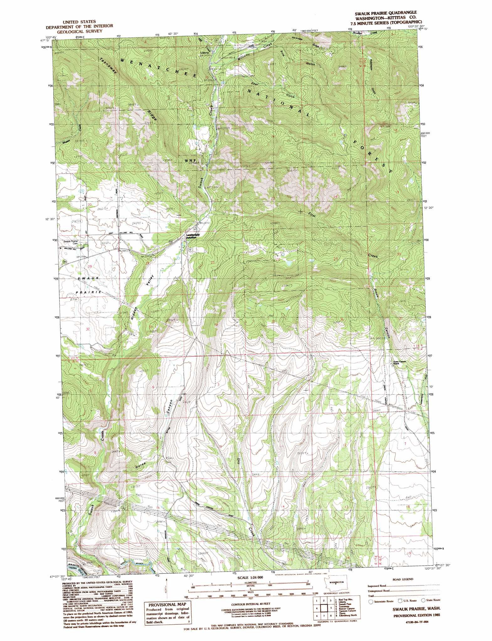
USGS Topo Quad 47120b6 - 1:24,000 scale
| Topo Map Name: | Swauk Prairie |
| USGS Topo Quad ID: | 47120b6 |
| Print Size: | ca. 21 1/4" wide x 27" high |
| Southeast Coordinates: | 47.125° N latitude / 120.625° W longitude |
| Map Center Coordinates: | 47.1875° N latitude / 120.6875° W longitude |
| U.S. State: | WA |
| Filename: | o47120b6.jpg |
| Download Map JPG Image: | Swauk Prairie topo map 1:24,000 scale |
| Map Type: | Topographic |
| Topo Series: | 7.5´ |
| Map Scale: | 1:24,000 |
| Source of Map Images: | United States Geological Survey (USGS) |
| Alternate Map Versions: |
Swauk Prairie WA 1985, updated 1985 Download PDF Buy paper map Swauk Prairie WA 1985, updated 1985 Download PDF Buy paper map Swauk Prairie WA 2003, updated 2006 Download PDF Buy paper map Swauk Prairie WA 2011 Download PDF Buy paper map Swauk Prairie WA 2014 Download PDF Buy paper map |
| FStopo: | US Forest Service topo Swauk Prairie is available: Download FStopo PDF Download FStopo TIF |
1:24,000 Topo Quads surrounding Swauk Prairie
Mount Stuart |
Enchantment Lakes |
Blewett |
Tiptop |
Monitor |
Teanaway Butte |
Red Top Mountain |
Liberty |
Swauk Pass |
Mission Peak |
Cle Elum |
Teanaway |
Swauk Prairie |
Reecer Canyon |
Naneum Canyon |
Frost Mountain |
Taneum Canyon |
Thorp |
Ellensburg North |
Colockum Pass Sw |
Manastash Lake |
Hudson Creek |
Manastash Creek |
Ellensburg South |
Kittitas |
> Back to 47120a1 at 1:100,000 scale
> Back to 47120a1 at 1:250,000 scale
> Back to U.S. Topo Maps home
Swauk Prairie topo map: Gazetteer
Swauk Prairie: Flats
Swauk Prairie elevation 689m 2260′Swauk Prairie: Lakes
Mill Pond elevation 661m 2168′Swauk Prairie: Mines
Old Placer Mine elevation 731m 2398′Swauk Prairie: Populated Places
Lauderdale Junction elevation 676m 2217′Swauk Prairie: Streams
First Creek elevation 676m 2217′Mill Creek elevation 744m 2440′
Williams Creek elevation 733m 2404′
Swauk Prairie: Valleys
Deer Gulch elevation 758m 2486′Green Canyon elevation 898m 2946′
Harness Gulch elevation 803m 2634′
Hidden Valley elevation 615m 2017′
Horse Canyon elevation 586m 1922′
Pine Gulch elevation 777m 2549′
Robinson Gulch elevation 922m 3024′
Swauk Prairie digital topo map on disk
Buy this Swauk Prairie topo map showing relief, roads, GPS coordinates and other geographical features, as a high-resolution digital map file on DVD: