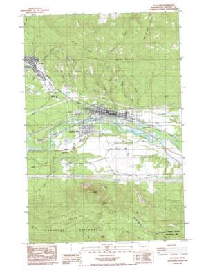
Cle Elum Topo Map Washington
To zoom in, hover over the map of Cle Elum
USGS Topo Quad 47120b8 - 1:24,000 scale
| Topo Map Name: | Cle Elum |
| USGS Topo Quad ID: | 47120b8 |
| Print Size: | ca. 21 1/4" wide x 27" high |
| Southeast Coordinates: | 47.125° N latitude / 120.875° W longitude |
| Map Center Coordinates: | 47.1875° N latitude / 120.9375° W longitude |
| U.S. State: | WA |
| Filename: | o47120b8.jpg |
| Download Map JPG Image: | Cle Elum topo map 1:24,000 scale |
| Map Type: | Topographic |
| Topo Series: | 7.5´ |
| Map Scale: | 1:24,000 |
| Source of Map Images: | United States Geological Survey (USGS) |
| Alternate Map Versions: |
Cle Elum WA 1984, updated 1985 Download PDF Buy paper map Cle Elum WA 1984, updated 1985 Download PDF Buy paper map Cle Elum WA 2003, updated 2006 Download PDF Buy paper map Cle Elum WA 2011 Download PDF Buy paper map Cle Elum WA 2014 Download PDF Buy paper map |
| FStopo: | US Forest Service topo Cle Elum is available: Download FStopo PDF Download FStopo TIF |
1:24,000 Topo Quads surrounding Cle Elum
> Back to 47120a1 at 1:100,000 scale
> Back to 47120a1 at 1:250,000 scale
> Back to U.S. Topo Maps home
Cle Elum topo map: Gazetteer
Cle Elum: Airports
Cle Elum Municipal Airport elevation 569m 1866′Cle Elum: Canals
Main Canal elevation 657m 2155′Cle Elum: Crossings
East Cle Elum Interchange elevation 585m 1919′Oakes Avenue Interchange elevation 586m 1922′
West Cle Elum Interchange elevation 612m 2007′
Cle Elum: Flats
Cedar Creek Meadows elevation 1202m 3943′Cle Elum: Mines
Goodrich Mine elevation 869m 2851′Independence Mine elevation 586m 1922′
Number 5 Mine elevation 674m 2211′
Number 7 Mine elevation 684m 2244′
Number 8 Mine elevation 959m 3146′
Number 9 Mine elevation 678m 2224′
Rothlisberger Mine elevation 616m 2020′
Cle Elum: Parks
Loggers Field elevation 583m 1912′Cle Elum: Populated Places
Cle Elum elevation 583m 1912′Roslyn elevation 685m 2247′
South Cle Elum elevation 586m 1922′
Cle Elum: Ridges
Cle Elum Ridge elevation 893m 2929′South Cle Elum Ridge elevation 1324m 4343′
Cle Elum: Springs
Lanigan Spring elevation 666m 2185′Lankin Spring elevation 1175m 3854′
Skull Spring elevation 1087m 3566′
Cle Elum: Streams
Cle Elum River elevation 592m 1942′Crystal Creek elevation 583m 1912′
Tillman Creek elevation 590m 1935′
Cle Elum: Summits
Cle Elum Point elevation 1208m 3963′Peoh Point elevation 1194m 3917′
Taneum Point elevation 1294m 4245′
Cle Elum: Valleys
Balmers Canyon elevation 622m 2040′Cedar Gulch elevation 719m 2358′
Curry Canyon elevation 644m 2112′
Greens Canyon elevation 595m 1952′
Number 5 Canyon elevation 658m 2158′
Number 6 Canyon elevation 708m 2322′
Steiners Canyon elevation 582m 1909′
Cle Elum digital topo map on disk
Buy this Cle Elum topo map showing relief, roads, GPS coordinates and other geographical features, as a high-resolution digital map file on DVD:


