Rock Island Topo Map Washington
To zoom in, hover over the map of Rock Island
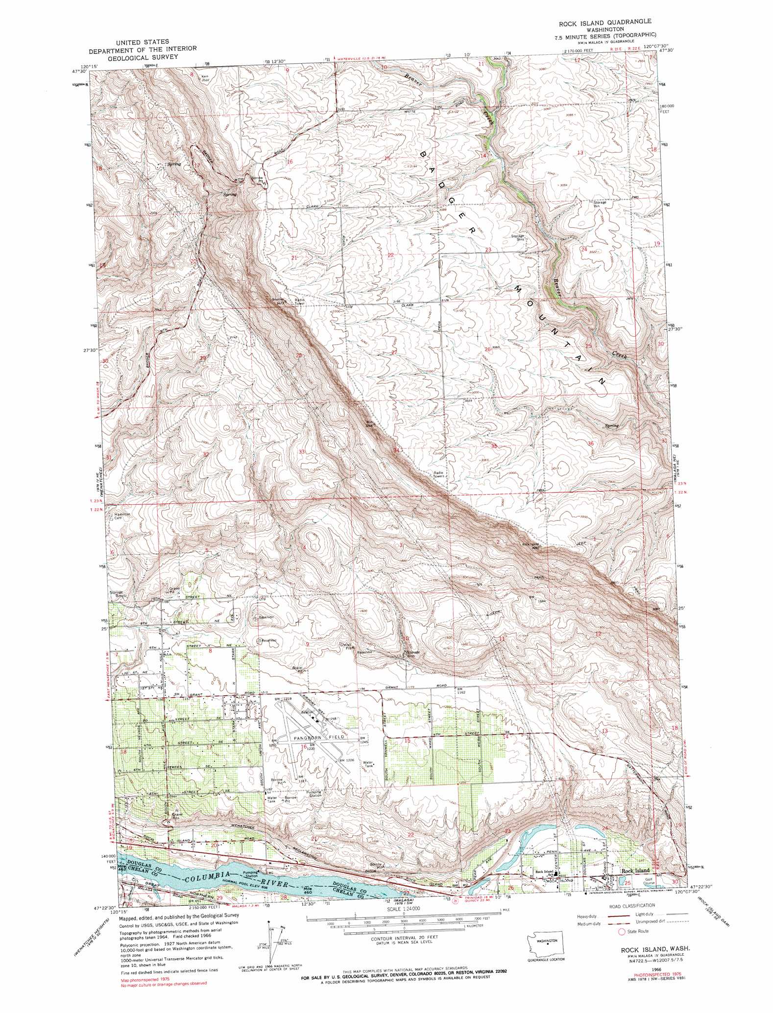
USGS Topo Quad 47120d2 - 1:24,000 scale
| Topo Map Name: | Rock Island |
| USGS Topo Quad ID: | 47120d2 |
| Print Size: | ca. 21 1/4" wide x 27" high |
| Southeast Coordinates: | 47.375° N latitude / 120.125° W longitude |
| Map Center Coordinates: | 47.4375° N latitude / 120.1875° W longitude |
| U.S. State: | WA |
| Filename: | o47120d2.jpg |
| Download Map JPG Image: | Rock Island topo map 1:24,000 scale |
| Map Type: | Topographic |
| Topo Series: | 7.5´ |
| Map Scale: | 1:24,000 |
| Source of Map Images: | United States Geological Survey (USGS) |
| Alternate Map Versions: |
Rock Island WA 1966, updated 1967 Download PDF Buy paper map Rock Island WA 1966, updated 1990 Download PDF Buy paper map Rock Island WA 2011 Download PDF Buy paper map Rock Island WA 2014 Download PDF Buy paper map |
| FStopo: | US Forest Service topo Rock Island is available: Download FStopo PDF Download FStopo TIF |
1:24,000 Topo Quads surrounding Rock Island
Chumstick Mountain |
Ardenvoir |
Entiat |
Waterville |
Lamoine |
Cashmere |
Rocky Reach Dam |
Orondo |
Douglas |
Alstown |
Monitor |
Wenatchee |
Rock Island |
Malaga Ne |
Palisades |
Mission Peak |
Wenatchee Heights |
Malaga |
Rock Island Dam |
Appledale |
Naneum Canyon |
Colockum Pass |
Stray Gulch |
West Bar |
Babcock Ridge |
> Back to 47120a1 at 1:100,000 scale
> Back to 47120a1 at 1:250,000 scale
> Back to U.S. Topo Maps home
Rock Island topo map: Gazetteer
Rock Island: Airports
Pangborn Field elevation 374m 1227′Rock Island: Lakes
Blue Heron Lake elevation 192m 629′Hideaway Lake elevation 188m 616′
Rock Island: Populated Places
Rock Island elevation 196m 643′Rock Island: Streams
Stemilt Creek elevation 186m 610′Rock Island digital topo map on disk
Buy this Rock Island topo map showing relief, roads, GPS coordinates and other geographical features, as a high-resolution digital map file on DVD: