Douglas Topo Map Washington
To zoom in, hover over the map of Douglas
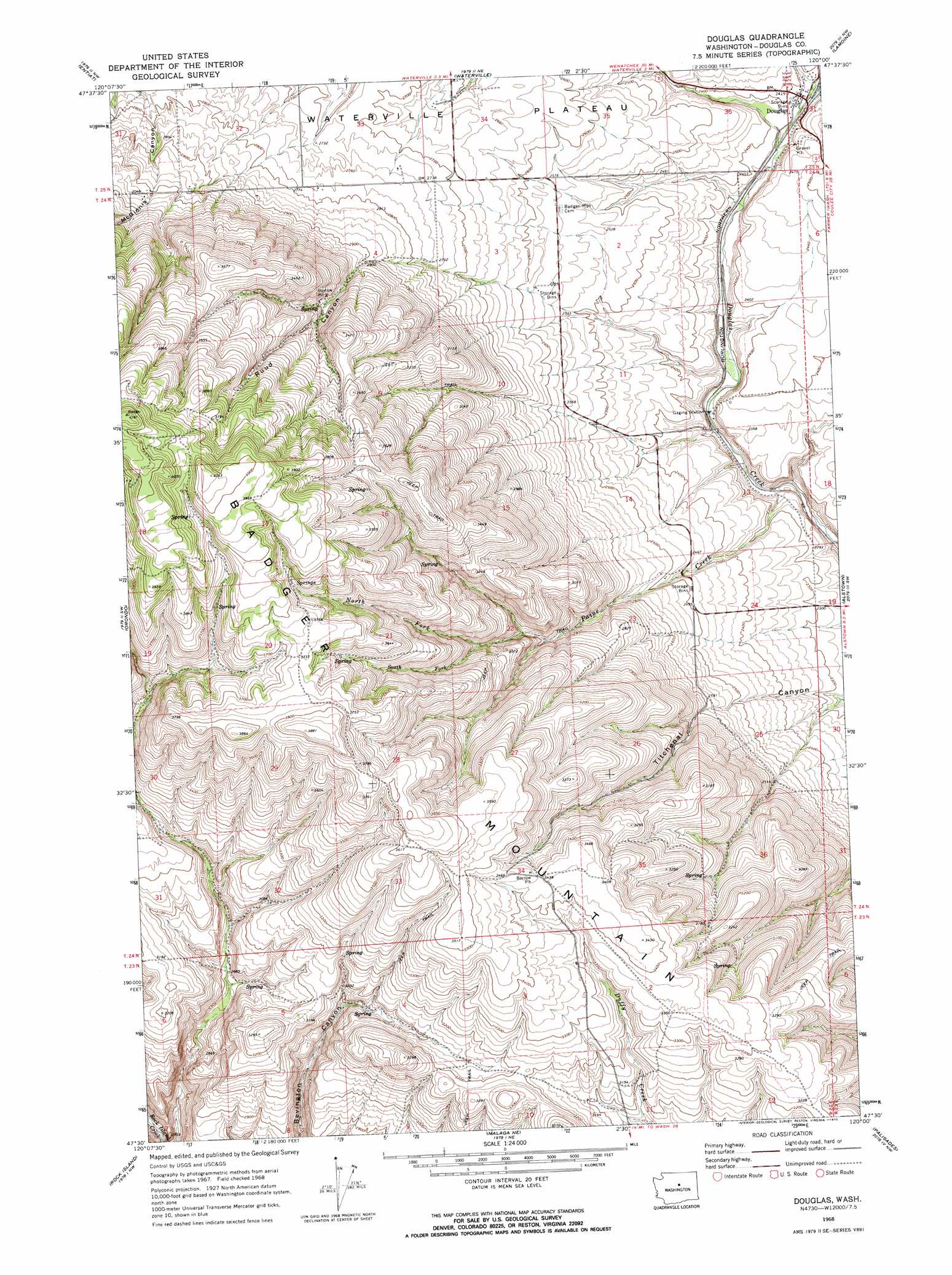
USGS Topo Quad 47120e1 - 1:24,000 scale
| Topo Map Name: | Douglas |
| USGS Topo Quad ID: | 47120e1 |
| Print Size: | ca. 21 1/4" wide x 27" high |
| Southeast Coordinates: | 47.5° N latitude / 120° W longitude |
| Map Center Coordinates: | 47.5625° N latitude / 120.0625° W longitude |
| U.S. State: | WA |
| Filename: | o47120e1.jpg |
| Download Map JPG Image: | Douglas topo map 1:24,000 scale |
| Map Type: | Topographic |
| Topo Series: | 7.5´ |
| Map Scale: | 1:24,000 |
| Source of Map Images: | United States Geological Survey (USGS) |
| Alternate Map Versions: |
Douglas WA 1968, updated 1972 Download PDF Buy paper map Douglas WA 1968, updated 1972 Download PDF Buy paper map Douglas WA 2011 Download PDF Buy paper map Douglas WA 2014 Download PDF Buy paper map |
1:24,000 Topo Quads surrounding Douglas
Baldy Mountain |
Winesap |
Chelan |
Chelan Falls |
Mud Spring |
Ardenvoir |
Entiat |
Waterville |
Lamoine |
Withrow |
Rocky Reach Dam |
Orondo |
Douglas |
Alstown |
Farmer |
Wenatchee |
Rock Island |
Malaga Ne |
Palisades |
Rattlesnake Springs |
Wenatchee Heights |
Malaga |
Rock Island Dam |
Appledale |
Monument Hill |
> Back to 47120e1 at 1:100,000 scale
> Back to 47120a1 at 1:250,000 scale
> Back to U.S. Topo Maps home
Douglas topo map: Gazetteer
Douglas: Populated Places
Douglas elevation 725m 2378′Douglas: Streams
North Fork Paine Creek elevation 854m 2801′Paine Creek elevation 674m 2211′
South Fork Paine Creek elevation 914m 2998′
Douglas: Valleys
Kummer Draw elevation 725m 2378′Ruud Canyon elevation 706m 2316′
Douglas digital topo map on disk
Buy this Douglas topo map showing relief, roads, GPS coordinates and other geographical features, as a high-resolution digital map file on DVD: