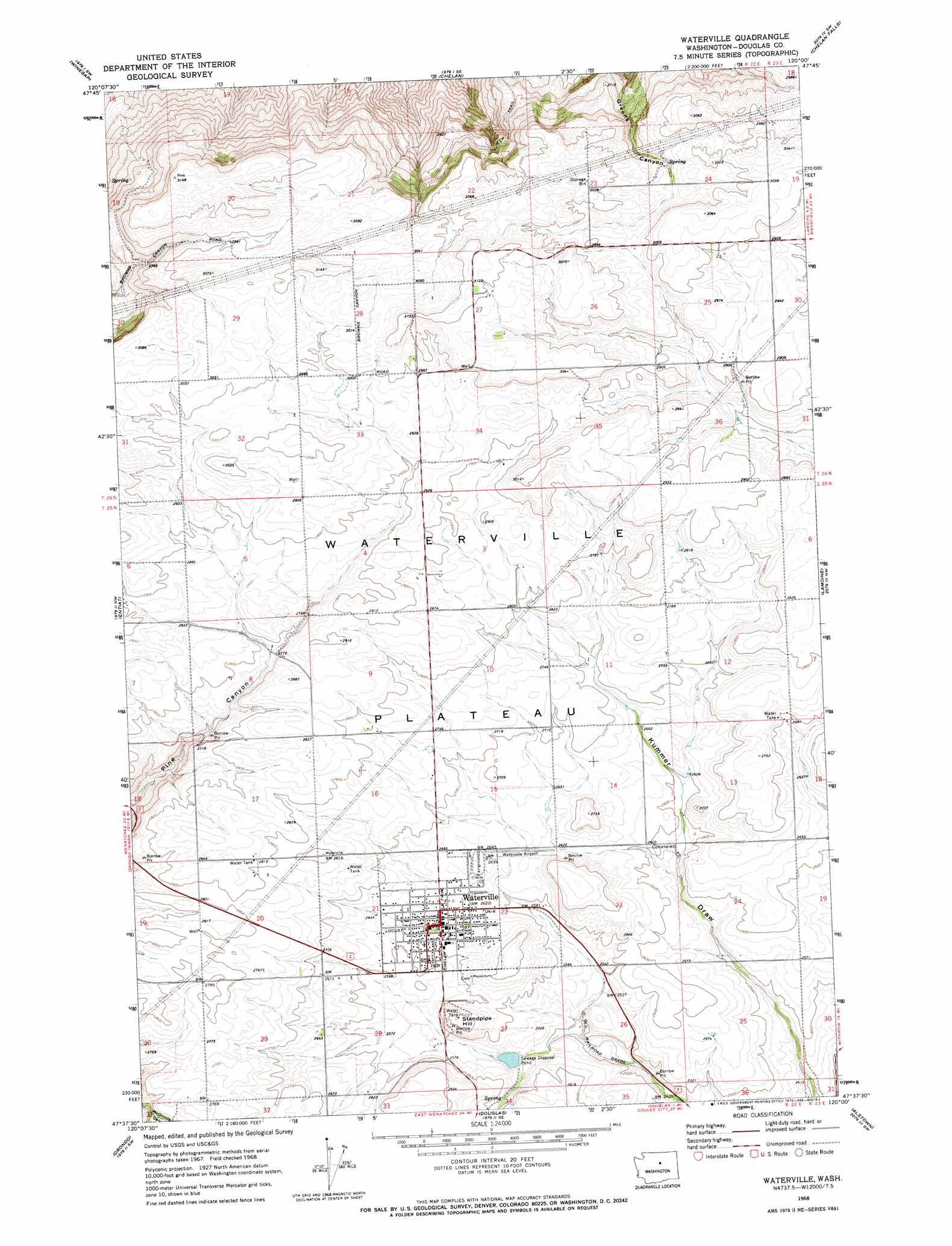
Waterville Topo Map Washington
To zoom in, hover over the map of Waterville
USGS Topo Quad 47120f1 - 1:24,000 scale
| Topo Map Name: | Waterville |
| USGS Topo Quad ID: | 47120f1 |
| Print Size: | ca. 21 1/4" wide x 27" high |
| Southeast Coordinates: | 47.625° N latitude / 120° W longitude |
| Map Center Coordinates: | 47.6875° N latitude / 120.0625° W longitude |
| U.S. State: | WA |
| Filename: | o47120f1.jpg |
| Download Map JPG Image: | Waterville topo map 1:24,000 scale |
| Map Type: | Topographic |
| Topo Series: | 7.5´ |
| Map Scale: | 1:24,000 |
| Source of Map Images: | United States Geological Survey (USGS) |
| Alternate Map Versions: |
Waterville WA 1968, updated 1972 Download PDF Buy paper map Waterville WA 2011 Download PDF Buy paper map Waterville WA 2014 Download PDF Buy paper map |
1:24,000 Topo Quads surrounding Waterville
Stormy Mountain |
Manson |
Cooper Ridge |
Azwell |
Wells Dam |
Baldy Mountain |
Winesap |
Chelan |
Chelan Falls |
Mud Spring |
Ardenvoir |
Entiat |
Waterville |
Lamoine |
Withrow |
Rocky Reach Dam |
Orondo |
Douglas |
Alstown |
Farmer |
Wenatchee |
Rock Island |
Malaga Ne |
Palisades |
Rattlesnake Springs |
> Back to 47120e1 at 1:100,000 scale
> Back to 47120a1 at 1:250,000 scale
> Back to U.S. Topo Maps home
Waterville topo map: Gazetteer
Waterville: Airports
Waterville Airport elevation 806m 2644′Waterville: Dams
McKay Dam elevation 874m 2867′Waterville Sewage Disposal Pond Dam elevation 770m 2526′
Waterville: Plains
Waterville Plateau elevation 871m 2857′Waterville: Populated Places
Waterville elevation 800m 2624′Waterville: Reservoirs
Waterville Sewage Disposal Pond elevation 770m 2526′Waterville: Summits
Standpipe Hill elevation 828m 2716′Waterville: Valleys
Douglas Draw elevation 731m 2398′McGinnis Canyon elevation 813m 2667′
Waterville digital topo map on disk
Buy this Waterville topo map showing relief, roads, GPS coordinates and other geographical features, as a high-resolution digital map file on DVD: