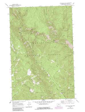
Sugarloaf Peak Topo Map Washington
To zoom in, hover over the map of Sugarloaf Peak
USGS Topo Quad 47120g5 - 1:24,000 scale
| Topo Map Name: | Sugarloaf Peak |
| USGS Topo Quad ID: | 47120g5 |
| Print Size: | ca. 21 1/4" wide x 27" high |
| Southeast Coordinates: | 47.75° N latitude / 120.5° W longitude |
| Map Center Coordinates: | 47.8125° N latitude / 120.5625° W longitude |
| U.S. State: | WA |
| Filename: | o47120g5.jpg |
| Download Map JPG Image: | Sugarloaf Peak topo map 1:24,000 scale |
| Map Type: | Topographic |
| Topo Series: | 7.5´ |
| Map Scale: | 1:24,000 |
| Source of Map Images: | United States Geological Survey (USGS) |
| Alternate Map Versions: |
Sugarloaf Peak WA 1968, updated 1972 Download PDF Buy paper map Sugarloaf Peak WA 1968, updated 1987 Download PDF Buy paper map Sugarloaf Peak WA 2004, updated 2008 Download PDF Buy paper map Sugarloaf Peak WA 2011 Download PDF Buy paper map Sugarloaf Peak WA 2014 Download PDF Buy paper map |
| FStopo: | US Forest Service topo Sugarloaf Peak is available: Download FStopo PDF Download FStopo TIF |
1:24,000 Topo Quads surrounding Sugarloaf Peak
> Back to 47120e1 at 1:100,000 scale
> Back to 47120a1 at 1:250,000 scale
> Back to U.S. Topo Maps home
Sugarloaf Peak topo map: Gazetteer
Sugarloaf Peak: Flats
Morrow Meadow elevation 684m 2244′Sugarloaf Peak: Gaps
Maverick Saddle elevation 1338m 4389′Sugarloaf Peak: Ranges
Entiat Mountains elevation 1587m 5206′Sugarloaf Peak: Ridges
Billy Ridge elevation 1520m 4986′Miners Ridge elevation 1697m 5567′
Sugarloaf Peak: Streams
Alma Creek elevation 1011m 3316′Berg Creek elevation 1202m 3943′
Billy Creek elevation 1072m 3517′
Cougar Creek elevation 1053m 3454′
Jimmy Creek elevation 1387m 4550′
Miners Creek elevation 1141m 3743′
South Fork Beaver Creek elevation 669m 2194′
Wilma Creek elevation 893m 2929′
Sugarloaf Peak: Summits
Maverick Peak elevation 1603m 5259′Sugarloaf Peak elevation 1766m 5793′
Sugarloaf Peak digital topo map on disk
Buy this Sugarloaf Peak topo map showing relief, roads, GPS coordinates and other geographical features, as a high-resolution digital map file on DVD:


