Plain Topo Map Washington
To zoom in, hover over the map of Plain
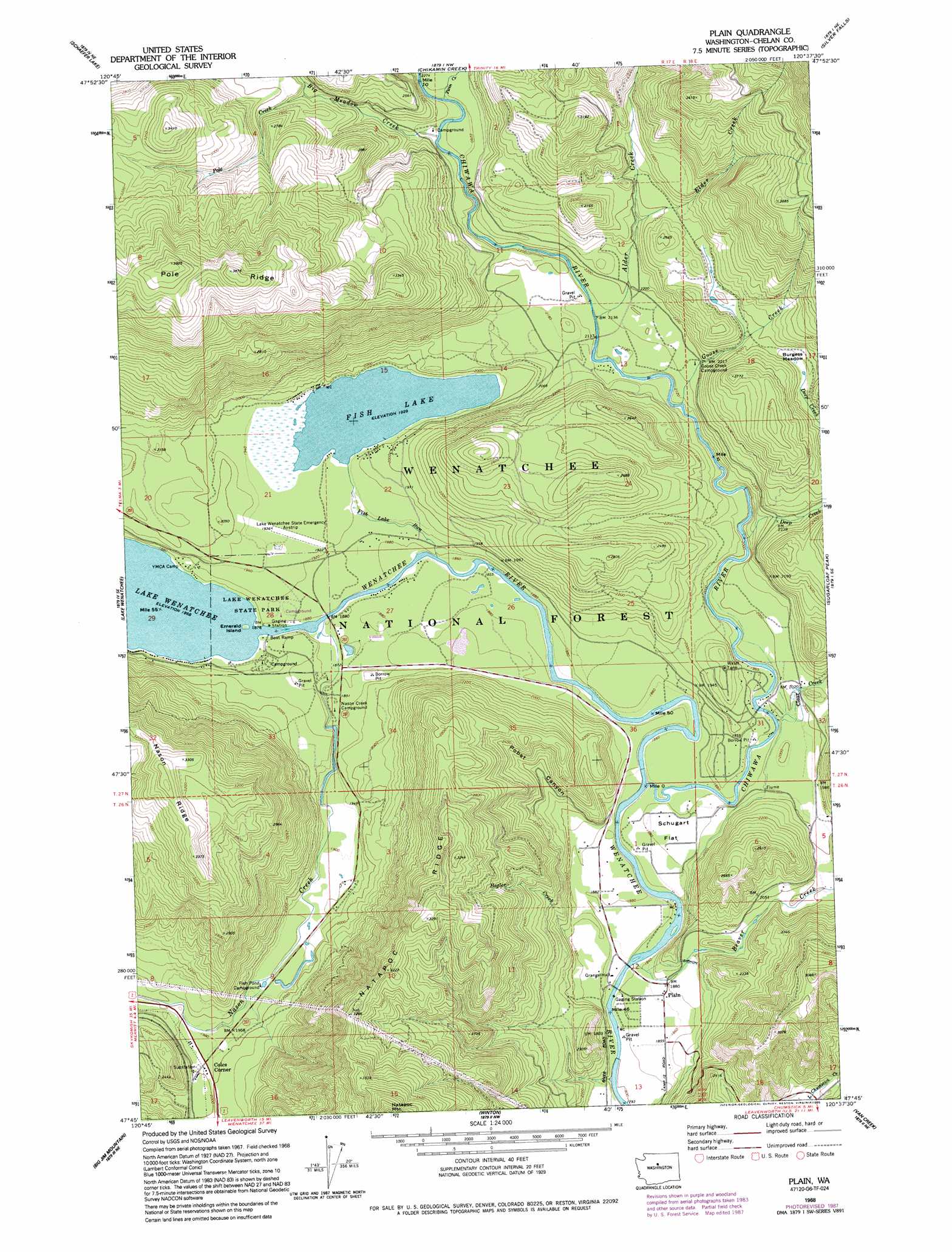
USGS Topo Quad 47120g6 - 1:24,000 scale
| Topo Map Name: | Plain |
| USGS Topo Quad ID: | 47120g6 |
| Print Size: | ca. 21 1/4" wide x 27" high |
| Southeast Coordinates: | 47.75° N latitude / 120.625° W longitude |
| Map Center Coordinates: | 47.8125° N latitude / 120.6875° W longitude |
| U.S. State: | WA |
| Filename: | o47120g6.jpg |
| Download Map JPG Image: | Plain topo map 1:24,000 scale |
| Map Type: | Topographic |
| Topo Series: | 7.5´ |
| Map Scale: | 1:24,000 |
| Source of Map Images: | United States Geological Survey (USGS) |
| Alternate Map Versions: |
Plain WA 1968, updated 1972 Download PDF Buy paper map Plain WA 1968, updated 1981 Download PDF Buy paper map Plain WA 1968, updated 1987 Download PDF Buy paper map Plain WA 1968, updated 1995 Download PDF Buy paper map Plain WA 2004, updated 2008 Download PDF Buy paper map Plain WA 2011 Download PDF Buy paper map Plain WA 2014 Download PDF Buy paper map |
| FStopo: | US Forest Service topo Plain is available: Download FStopo PDF Download FStopo TIF |
1:24,000 Topo Quads surrounding Plain
Clark Mountain |
Trinity |
Saska Peak |
Pyramid Mountain |
Big Goat Mountain |
Mount David |
Schaefer Lake |
Chikamin Creek |
Silver Falls |
Brief |
Mount Howard |
Lake Wenatchee |
Plain |
Sugarloaf Peak |
Tyee Mountain |
Chiwaukum Mountains |
Big Jim Mountain |
Winton |
Van Creek |
Chumstick Mountain |
Jack Ridge |
Cashmere Mountain |
Leavenworth |
Peshastin |
Cashmere |
> Back to 47120e1 at 1:100,000 scale
> Back to 47120a1 at 1:250,000 scale
> Back to U.S. Topo Maps home
Plain topo map: Gazetteer
Plain: Airports
Lake Wenatchee State Airport elevation 588m 1929′Pearly Gates Ranch Airport elevation 578m 1896′
Plain: Flats
Burgess Meadow elevation 717m 2352′Schugart Flat elevation 579m 1899′
Plain: Islands
Emerald Island elevation 571m 1873′Plain: Lakes
Fish Lake elevation 589m 1932′Plain: Parks
Lake Wenatchee State Park elevation 575m 1886′Plain: Populated Places
Coles Corner elevation 608m 1994′Plain elevation 570m 1870′
Plain: Ridges
Pole Ridge elevation 1200m 3937′Plain: Streams
Alder Creek elevation 649m 2129′Beaver Creek elevation 556m 1824′
Big Meadow Creek elevation 681m 2234′
Chiwawa River elevation 562m 1843′
Clear Creek elevation 587m 1925′
Deep Creek elevation 604m 1981′
Elder Creek elevation 712m 2335′
Fish Lake Run elevation 568m 1863′
Goose Creek elevation 640m 2099′
Hegler Creek elevation 593m 1945′
Nason Creek elevation 570m 1870′
Pole Creek elevation 745m 2444′
Twin Creek elevation 690m 2263′
Plain: Valleys
Pobst Canyon elevation 586m 1922′Plain digital topo map on disk
Buy this Plain topo map showing relief, roads, GPS coordinates and other geographical features, as a high-resolution digital map file on DVD: