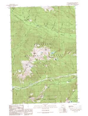
Mount Howard Topo Map Washington
To zoom in, hover over the map of Mount Howard
USGS Topo Quad 47120g8 - 1:24,000 scale
| Topo Map Name: | Mount Howard |
| USGS Topo Quad ID: | 47120g8 |
| Print Size: | ca. 21 1/4" wide x 27" high |
| Southeast Coordinates: | 47.75° N latitude / 120.875° W longitude |
| Map Center Coordinates: | 47.8125° N latitude / 120.9375° W longitude |
| U.S. State: | WA |
| Filename: | o47120g8.jpg |
| Download Map JPG Image: | Mount Howard topo map 1:24,000 scale |
| Map Type: | Topographic |
| Topo Series: | 7.5´ |
| Map Scale: | 1:24,000 |
| Source of Map Images: | United States Geological Survey (USGS) |
| Alternate Map Versions: |
Mount Howard WA 1989, updated 1989 Download PDF Buy paper map Mount Howard WA 2004, updated 2008 Download PDF Buy paper map Mount Howard WA 2011 Download PDF Buy paper map Mount Howard WA 2014 Download PDF Buy paper map |
| FStopo: | US Forest Service topo Mount Howard is available: Download FStopo PDF Download FStopo TIF |
1:24,000 Topo Quads surrounding Mount Howard
> Back to 47120e1 at 1:100,000 scale
> Back to 47120a1 at 1:250,000 scale
> Back to U.S. Topo Maps home
Mount Howard topo map: Gazetteer
Mount Howard: Lakes
Canan Lake elevation 1803m 5915′Crescent Lake elevation 1665m 5462′
Lake Ethel elevation 1678m 5505′
Lost Lake elevation 1504m 4934′
Merritt Lake elevation 1533m 5029′
Rock Lake elevation 1787m 5862′
Mount Howard: Parks
Fir Creek Recreation Area elevation 650m 2132′Mount Howard: Populated Places
Berne elevation 867m 2844′Mount Howard: Ridges
Nason Ridge elevation 1793m 5882′Mount Howard: Springs
Soda Spring elevation 664m 2178′Mount Howard: Streams
Cedar Creek elevation 600m 1968′Crescent Creek elevation 774m 2539′
Fir Creek elevation 601m 1971′
Henry Creek elevation 867m 2844′
Hidden Creek elevation 592m 1942′
Line Creek elevation 586m 1922′
Lost Creek elevation 584m 1916′
Mahar Creek elevation 684m 2244′
Ninemile Creek elevation 646m 2119′
Peavine Creek elevation 636m 2086′
Rainy Creek elevation 635m 2083′
Royal Creek elevation 738m 2421′
Schilling Creek elevation 782m 2565′
Snowy Creek elevation 903m 2962′
Soda Creek elevation 646m 2119′
Whitepine Creek elevation 707m 2319′
Mount Howard: Summits
Arrowhead Mountain elevation 1830m 6003′Mount Howard elevation 2116m 6942′
Mount Mastiff elevation 2053m 6735′
Rock Mountain elevation 2087m 6847′
Mount Howard digital topo map on disk
Buy this Mount Howard topo map showing relief, roads, GPS coordinates and other geographical features, as a high-resolution digital map file on DVD:


