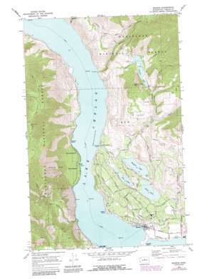
Manson Topo Map Washington
To zoom in, hover over the map of Manson
USGS Topo Quad 47120h2 - 1:24,000 scale
| Topo Map Name: | Manson |
| USGS Topo Quad ID: | 47120h2 |
| Print Size: | ca. 21 1/4" wide x 27" high |
| Southeast Coordinates: | 47.875° N latitude / 120.125° W longitude |
| Map Center Coordinates: | 47.9375° N latitude / 120.1875° W longitude |
| U.S. State: | WA |
| Filename: | o47120h2.jpg |
| Download Map JPG Image: | Manson topo map 1:24,000 scale |
| Map Type: | Topographic |
| Topo Series: | 7.5´ |
| Map Scale: | 1:24,000 |
| Source of Map Images: | United States Geological Survey (USGS) |
| Alternate Map Versions: |
Manson WA 1968, updated 1973 Download PDF Buy paper map Manson WA 1968, updated 1987 Download PDF Buy paper map Manson WA 2004, updated 2008 Download PDF Buy paper map Manson WA 2011 Download PDF Buy paper map Manson WA 2014 Download PDF Buy paper map |
| FStopo: | US Forest Service topo Manson is available: Download FStopo PDF Download FStopo TIF |
1:24,000 Topo Quads surrounding Manson
> Back to 47120e1 at 1:100,000 scale
> Back to 47120a1 at 1:250,000 scale
> Back to U.S. Topo Maps home
Manson topo map: Gazetteer
Manson: Bays
Missouri Harbor elevation 336m 1102′Manson: Capes
Fields Point elevation 346m 1135′Willow Point elevation 346m 1135′
Manson: Dams
Antilon Lake Dam elevation 710m 2329′Antilon Saddle Dam elevation 1031m 3382′
Antilon Saddle Dam Number Two elevation 720m 2362′
Wapato Lake Dam elevation 378m 1240′
Manson: Lakes
Dry Lake elevation 356m 1167′Roses Lake elevation 356m 1167′
Manson: Parks
Old Mill Park elevation 337m 1105′Manson: Populated Places
Granite Falls elevation 343m 1125′Greens Landing elevation 367m 1204′
Hollywood Beach elevation 354m 1161′
Manson elevation 348m 1141′
Shrine Beach elevation 345m 1131′
Manson: Reservoirs
Antilon Lake elevation 711m 2332′Wapato Lake elevation 378m 1240′
Manson: Slopes
Granite Slide elevation 814m 2670′Manson: Streams
Antilon Creek elevation 371m 1217′East Fork Joe Creek elevation 683m 2240′
First Creek elevation 336m 1102′
Gold Creek elevation 350m 1148′
Granite Falls Creek elevation 336m 1102′
Joe Creek elevation 376m 1233′
Johnson Creek elevation 597m 1958′
Mitchell Creek elevation 358m 1174′
Stink Creek elevation 341m 1118′
Manson: Summits
Fourth of July Mountain elevation 1062m 3484′Manson digital topo map on disk
Buy this Manson topo map showing relief, roads, GPS coordinates and other geographical features, as a high-resolution digital map file on DVD:


