Schaefer Lake Topo Map Washington
To zoom in, hover over the map of Schaefer Lake
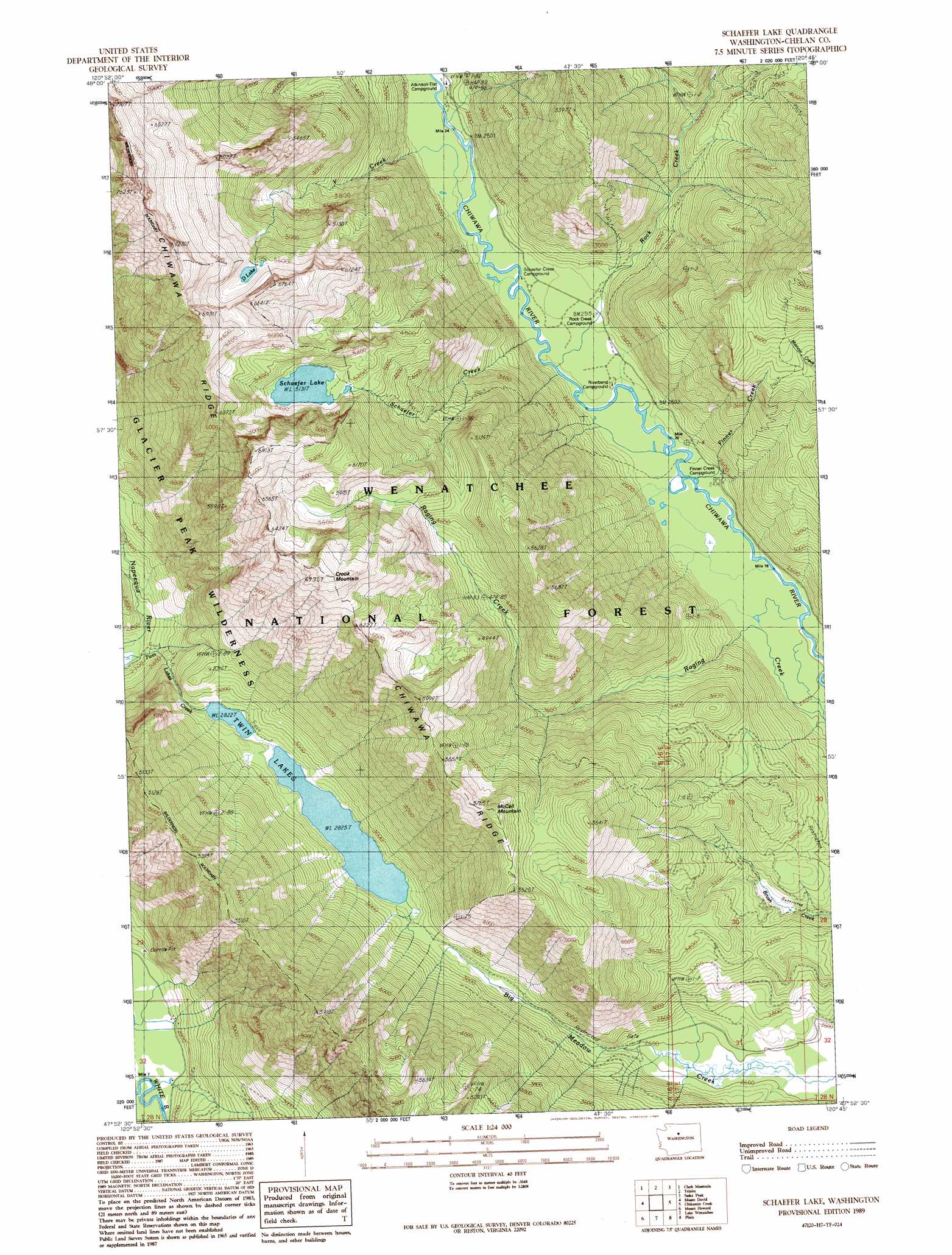
USGS Topo Quad 47120h7 - 1:24,000 scale
| Topo Map Name: | Schaefer Lake |
| USGS Topo Quad ID: | 47120h7 |
| Print Size: | ca. 21 1/4" wide x 27" high |
| Southeast Coordinates: | 47.875° N latitude / 120.75° W longitude |
| Map Center Coordinates: | 47.9375° N latitude / 120.8125° W longitude |
| U.S. State: | WA |
| Filename: | o47120h7.jpg |
| Download Map JPG Image: | Schaefer Lake topo map 1:24,000 scale |
| Map Type: | Topographic |
| Topo Series: | 7.5´ |
| Map Scale: | 1:24,000 |
| Source of Map Images: | United States Geological Survey (USGS) |
| Alternate Map Versions: |
Schaffer Lake WA 1989, updated 1989 Download PDF Buy paper map Schaffer Lake WA 2004, updated 2008 Download PDF Buy paper map Schaefer Lake WA 2011 Download PDF Buy paper map Schaefer Lake WA 2014 Download PDF Buy paper map |
| FStopo: | US Forest Service topo Schaefer Lake is available: Download FStopo PDF Download FStopo TIF |
1:24,000 Topo Quads surrounding Schaefer Lake
Gamma Peak |
Suiattle Pass |
Holden |
Pinnacle Mountain |
Lucerne |
Glacier Peak East |
Clark Mountain |
Trinity |
Saska Peak |
Pyramid Mountain |
Poe Mountain |
Mount David |
Schaefer Lake |
Chikamin Creek |
Silver Falls |
Labyrinth Mountain |
Mount Howard |
Lake Wenatchee |
Plain |
Sugarloaf Peak |
Stevens Pass |
Chiwaukum Mountains |
Big Jim Mountain |
Winton |
Van Creek |
> Back to 47120e1 at 1:100,000 scale
> Back to 47120a1 at 1:250,000 scale
> Back to U.S. Topo Maps home
Schaefer Lake topo map: Gazetteer
Schaefer Lake: Lakes
D Lake elevation 1717m 5633′Schaefer Lake elevation 1565m 5134′
Twin Lakes elevation 862m 2828′
Schaefer Lake: Streams
Finner Creek elevation 1010m 3313′Schaefer Creek elevation 747m 2450′
Y Creek elevation 754m 2473′
Schaefer Lake: Summits
Crook Mountain elevation 1821m 5974′McCall Mountain elevation 1759m 5770′
Schaefer Lake digital topo map on disk
Buy this Schaefer Lake topo map showing relief, roads, GPS coordinates and other geographical features, as a high-resolution digital map file on DVD: