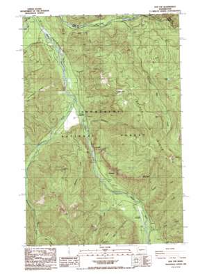
Sun Top Topo Map Washington
To zoom in, hover over the map of Sun Top
USGS Topo Quad 47121a5 - 1:24,000 scale
| Topo Map Name: | Sun Top |
| USGS Topo Quad ID: | 47121a5 |
| Print Size: | ca. 21 1/4" wide x 27" high |
| Southeast Coordinates: | 47° N latitude / 121.5° W longitude |
| Map Center Coordinates: | 47.0625° N latitude / 121.5625° W longitude |
| U.S. State: | WA |
| Filename: | o47121a5.jpg |
| Download Map JPG Image: | Sun Top topo map 1:24,000 scale |
| Map Type: | Topographic |
| Topo Series: | 7.5´ |
| Map Scale: | 1:24,000 |
| Source of Map Images: | United States Geological Survey (USGS) |
| Alternate Map Versions: |
Sun Top WA 1986, updated 1986 Download PDF Buy paper map Sun Top WA 2011 Download PDF Buy paper map Sun Top WA 2014 Download PDF Buy paper map |
| FStopo: | US Forest Service topo Sun Top is available: Download FStopo PDF Download FStopo TIF |
1:24,000 Topo Quads surrounding Sun Top
> Back to 47121a1 at 1:100,000 scale
> Back to 47120a1 at 1:250,000 scale
> Back to U.S. Topo Maps home
Sun Top topo map: Gazetteer
Sun Top: Airports
Ranger Creek State Airport elevation 790m 2591′Sun Top: Cliffs
The Dalles elevation 686m 2250′Sun Top: Forests
White River Ranger District elevation 1377m 4517′Sun Top: Lakes
Dalles Lakes elevation 1385m 4543′Forest Lake elevation 1204m 3950′
Twentyeight Mile Lake elevation 1517m 4977′
Sun Top: Populated Places
Snoquera elevation 735m 2411′Sun Top: Ridges
Dalles Ridge elevation 1735m 5692′Sun Top: Streams
Boundary Creek elevation 603m 1978′Buck Creek elevation 742m 2434′
Burns Creek elevation 672m 2204′
Deep Creek elevation 779m 2555′
Doe Creek elevation 723m 2372′
Dry Creek elevation 771m 2529′
Foss Creek elevation 610m 2001′
Huckleberry Creek elevation 635m 2083′
Lightning Creek elevation 643m 2109′
Lost Creek elevation 907m 2975′
Minnehaha Creek elevation 657m 2155′
Ranger Creek elevation 754m 2473′
Skookum Creek elevation 678m 2224′
Slide Creek elevation 639m 2096′
Twentyeight Mile Creek elevation 636m 2086′
West Fork White River elevation 563m 1847′
Sun Top: Summits
Little Ranger Peak elevation 1544m 5065′Sun Top elevation 1604m 5262′
Sun Top: Trails
Sun Top Trail elevation 1584m 5196′Twentyeight Mile Creek Trail elevation 1333m 4373′
Sun Top digital topo map on disk
Buy this Sun Top topo map showing relief, roads, GPS coordinates and other geographical features, as a high-resolution digital map file on DVD:


