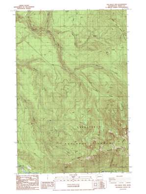
Old Baldy Mountain Topo Map Washington
To zoom in, hover over the map of Old Baldy Mountain
USGS Topo Quad 47121a8 - 1:24,000 scale
| Topo Map Name: | Old Baldy Mountain |
| USGS Topo Quad ID: | 47121a8 |
| Print Size: | ca. 21 1/4" wide x 27" high |
| Southeast Coordinates: | 47° N latitude / 121.875° W longitude |
| Map Center Coordinates: | 47.0625° N latitude / 121.9375° W longitude |
| U.S. State: | WA |
| Filename: | o47121a8.jpg |
| Download Map JPG Image: | Old Baldy Mountain topo map 1:24,000 scale |
| Map Type: | Topographic |
| Topo Series: | 7.5´ |
| Map Scale: | 1:24,000 |
| Source of Map Images: | United States Geological Survey (USGS) |
| Alternate Map Versions: |
Old Baldy Mtn. WA 1986, updated 1987 Download PDF Buy paper map Old Baldy Mountain WA 2011 Download PDF Buy paper map Old Baldy Mountain WA 2014 Download PDF Buy paper map |
| FStopo: | US Forest Service topo Old Baldy Mountain is available: Download FStopo PDF Download FStopo TIF |
1:24,000 Topo Quads surrounding Old Baldy Mountain
> Back to 47121a1 at 1:100,000 scale
> Back to 47120a1 at 1:250,000 scale
> Back to U.S. Topo Maps home
Old Baldy Mountain topo map: Gazetteer
Old Baldy Mountain: Ridges
Burnt Mountain elevation 1376m 4514′Carbon Ridge elevation 1546m 5072′
Old Baldy Mountain: Streams
Beaver Creek elevation 307m 1007′East Fork South Prairie Creek elevation 501m 1643′
New Pond Creek elevation 334m 1095′
South Fork Gale Creek elevation 441m 1446′
South Fork South Prairie Creek elevation 510m 1673′
Old Baldy Mountain: Summits
Old Baldy Mountain elevation 1761m 5777′The Three Sisters elevation 1237m 4058′
Old Baldy Mountain digital topo map on disk
Buy this Old Baldy Mountain topo map showing relief, roads, GPS coordinates and other geographical features, as a high-resolution digital map file on DVD:


