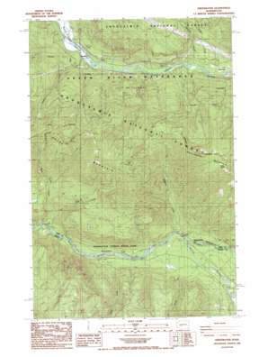
Greenwater Topo Map Washington
To zoom in, hover over the map of Greenwater
USGS Topo Quad 47121b6 - 1:24,000 scale
| Topo Map Name: | Greenwater |
| USGS Topo Quad ID: | 47121b6 |
| Print Size: | ca. 21 1/4" wide x 27" high |
| Southeast Coordinates: | 47.125° N latitude / 121.625° W longitude |
| Map Center Coordinates: | 47.1875° N latitude / 121.6875° W longitude |
| U.S. State: | WA |
| Filename: | o47121b6.jpg |
| Download Map JPG Image: | Greenwater topo map 1:24,000 scale |
| Map Type: | Topographic |
| Topo Series: | 7.5´ |
| Map Scale: | 1:24,000 |
| Source of Map Images: | United States Geological Survey (USGS) |
| Alternate Map Versions: |
Greenwater WA 1986, updated 1986 Download PDF Buy paper map Greenwater WA 1986, updated 1986 Download PDF Buy paper map Greenwater WA 2011 Download PDF Buy paper map Greenwater WA 2014 Download PDF Buy paper map |
| FStopo: | US Forest Service topo Greenwater is available: Download FStopo PDF Download FStopo TIF |
1:24,000 Topo Quads surrounding Greenwater
> Back to 47121a1 at 1:100,000 scale
> Back to 47120a1 at 1:250,000 scale
> Back to U.S. Topo Maps home
Greenwater topo map: Gazetteer
Greenwater: Flats
Deadman Flat elevation 502m 1646′Greenwater: Parks
Federation Forest State Park elevation 528m 1732′Greenwater: Populated Places
Greenwater elevation 518m 1699′Humphrey elevation 368m 1207′
Maywood elevation 433m 1420′
Greenwater: Springs
Mule Spring elevation 1279m 4196′Greenwater: Streams
Camp Creek elevation 485m 1591′Canton Creek elevation 360m 1181′
Cougar Creek elevation 402m 1318′
East Twin Creek elevation 457m 1499′
Greenwater River elevation 561m 1840′
Rocky Run elevation 502m 1646′
Slippery Creek elevation 534m 1751′
Sylvester Creek elevation 413m 1354′
West Twin Creek elevation 452m 1482′
Greenwater: Trails
Bone Lake Trail elevation 937m 3074′Christoff Trail elevation 920m 3018′
Greenwater digital topo map on disk
Buy this Greenwater topo map showing relief, roads, GPS coordinates and other geographical features, as a high-resolution digital map file on DVD:


