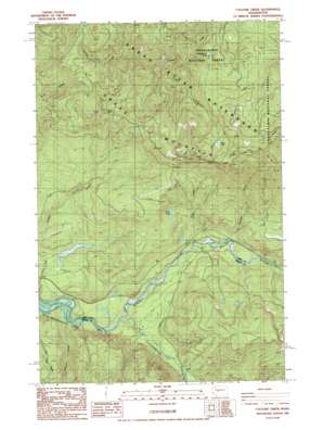
Cyclone Creek Topo Map Washington
To zoom in, hover over the map of Cyclone Creek
USGS Topo Quad 47121b7 - 1:24,000 scale
| Topo Map Name: | Cyclone Creek |
| USGS Topo Quad ID: | 47121b7 |
| Print Size: | ca. 21 1/4" wide x 27" high |
| Southeast Coordinates: | 47.125° N latitude / 121.75° W longitude |
| Map Center Coordinates: | 47.1875° N latitude / 121.8125° W longitude |
| U.S. State: | WA |
| Filename: | o47121b7.jpg |
| Download Map JPG Image: | Cyclone Creek topo map 1:24,000 scale |
| Map Type: | Topographic |
| Topo Series: | 7.5´ |
| Map Scale: | 1:24,000 |
| Source of Map Images: | United States Geological Survey (USGS) |
| Alternate Map Versions: |
Cyclone Creek WA 1986, updated 1986 Download PDF Buy paper map Cyclone Creek WA 2011 Download PDF Buy paper map Cyclone Creek WA 2014 Download PDF Buy paper map |
| FStopo: | US Forest Service topo Cyclone Creek is available: Download FStopo PDF Download FStopo TIF |
1:24,000 Topo Quads surrounding Cyclone Creek
> Back to 47121a1 at 1:100,000 scale
> Back to 47120a1 at 1:250,000 scale
> Back to U.S. Topo Maps home
Cyclone Creek topo map: Gazetteer
Cyclone Creek: Lakes
Beaverdam Lake elevation 577m 1893′Lynn Lake elevation 1056m 3464′
Stink Lake elevation 679m 2227′
Cyclone Creek: Ridges
Grass Mountain elevation 1243m 4078′Cyclone Creek: Streams
Canyon Creek elevation 362m 1187′Charley Creek elevation 417m 1368′
Clay Creek elevation 409m 1341′
Clearwater River elevation 382m 1253′
Cyclone Creek elevation 419m 1374′
Packard Creek elevation 415m 1361′
Cyclone Creek digital topo map on disk
Buy this Cyclone Creek topo map showing relief, roads, GPS coordinates and other geographical features, as a high-resolution digital map file on DVD:


