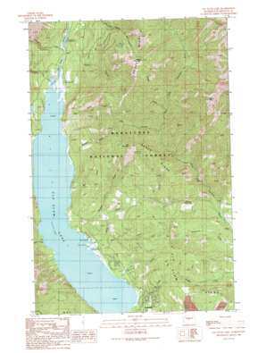
Cle Elum Lake Topo Map Washington
To zoom in, hover over the map of Cle Elum Lake
USGS Topo Quad 47121c1 - 1:24,000 scale
| Topo Map Name: | Cle Elum Lake |
| USGS Topo Quad ID: | 47121c1 |
| Print Size: | ca. 21 1/4" wide x 27" high |
| Southeast Coordinates: | 47.25° N latitude / 121° W longitude |
| Map Center Coordinates: | 47.3125° N latitude / 121.0625° W longitude |
| U.S. State: | WA |
| Filename: | o47121c1.jpg |
| Download Map JPG Image: | Cle Elum Lake topo map 1:24,000 scale |
| Map Type: | Topographic |
| Topo Series: | 7.5´ |
| Map Scale: | 1:24,000 |
| Source of Map Images: | United States Geological Survey (USGS) |
| Alternate Map Versions: |
Cle Elum Lake WA 1989, updated 1989 Download PDF Buy paper map Cle Elum Lake WA 1989, updated 1989 Download PDF Buy paper map Cle Elum Lake WA 2003, updated 2006 Download PDF Buy paper map Cle Elum Lake WA 2011 Download PDF Buy paper map Cle Elum Lake WA 2014 Download PDF Buy paper map |
| FStopo: | US Forest Service topo Cle Elum Lake is available: Download FStopo PDF Download FStopo TIF |
1:24,000 Topo Quads surrounding Cle Elum Lake
> Back to 47121a1 at 1:100,000 scale
> Back to 47120a1 at 1:250,000 scale
> Back to U.S. Topo Maps home
Cle Elum Lake topo map: Gazetteer
Cle Elum Lake: Populated Places
Driftwood Acres elevation 712m 2335′Lakedale elevation 700m 2296′
Cle Elum Lake: Ridges
Sasse Ridge elevation 1617m 5305′Cle Elum Lake: Streams
Bear Creek elevation 680m 2230′Bell Creek elevation 679m 2227′
Corral Creek elevation 814m 2670′
Davis Creek elevation 694m 2276′
Dry Creek elevation 679m 2227′
French Cabin Creek elevation 694m 2276′
Hex Creek elevation 955m 3133′
Howson Creek elevation 688m 2257′
Mill Creek elevation 681m 2234′
Morgan Creek elevation 679m 2227′
Newport Creek elevation 697m 2286′
Para Creek elevation 679m 2227′
Spring Creek elevation 679m 2227′
Thorp Creek elevation 692m 2270′
Tumble Creek elevation 1002m 3287′
Cle Elum Lake: Summits
Elbow Peak elevation 1701m 5580′Hex Mountain elevation 1521m 4990′
Sasse Mountain elevation 1733m 5685′
Cle Elum Lake: Trails
Sasse Mountain Trail elevation 1640m 5380′Cle Elum Lake digital topo map on disk
Buy this Cle Elum Lake topo map showing relief, roads, GPS coordinates and other geographical features, as a high-resolution digital map file on DVD:


