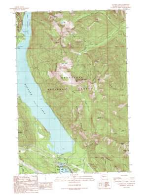
Kachess Lake Topo Map Washington
To zoom in, hover over the map of Kachess Lake
USGS Topo Quad 47121c2 - 1:24,000 scale
| Topo Map Name: | Kachess Lake |
| USGS Topo Quad ID: | 47121c2 |
| Print Size: | ca. 21 1/4" wide x 27" high |
| Southeast Coordinates: | 47.25° N latitude / 121.125° W longitude |
| Map Center Coordinates: | 47.3125° N latitude / 121.1875° W longitude |
| U.S. State: | WA |
| Filename: | o47121c2.jpg |
| Download Map JPG Image: | Kachess Lake topo map 1:24,000 scale |
| Map Type: | Topographic |
| Topo Series: | 7.5´ |
| Map Scale: | 1:24,000 |
| Source of Map Images: | United States Geological Survey (USGS) |
| Alternate Map Versions: |
Kachess Lake WA 1989, updated 1989 Download PDF Buy paper map Kachess Lake WA 1989, updated 1989 Download PDF Buy paper map Kachess Lake WA 2003, updated 2006 Download PDF Buy paper map Kachess Lake WA 2011 Download PDF Buy paper map Kachess Lake WA 2014 Download PDF Buy paper map |
| FStopo: | US Forest Service topo Kachess Lake is available: Download FStopo PDF Download FStopo TIF |
1:24,000 Topo Quads surrounding Kachess Lake
> Back to 47121a1 at 1:100,000 scale
> Back to 47120a1 at 1:250,000 scale
> Back to U.S. Topo Maps home
Kachess Lake topo map: Gazetteer
Kachess Lake: Airports
Easton State Airport elevation 676m 2217′Kachess Lake: Basins
French Cabin Basin elevation 1382m 4534′Kachess Lake: Dams
Kachess Dam elevation 685m 2247′Kachess Lake: Lakes
Thorp Lake elevation 1428m 4685′Kachess Lake: Parks
Lake Easton State Park elevation 671m 2201′Kachess Lake: Reservoirs
Kachess Lake elevation 685m 2247′Kachess Lake: Ridges
Kachess Ridge elevation 1547m 5075′Kachess Lake: Streams
Box Canyon Creek elevation 688m 2257′Branch Creek elevation 687m 2253′
Gale Creek elevation 688m 2257′
Hudson Creek elevation 672m 2204′
Kachess River elevation 666m 2185′
Knox Creek elevation 1001m 3284′
South Fork French Cabin Creek elevation 1111m 3645′
West Fork French Cabin Creek elevation 1066m 3497′
Kachess Lake: Summits
Domerie Peak elevation 1413m 4635′Frenchman Mountain elevation 1393m 4570′
Mount Baldy elevation 1526m 5006′
North Peak elevation 1677m 5501′
South Peak elevation 1682m 5518′
Thomas Mountain elevation 1592m 5223′
Thorp Mountain elevation 1785m 5856′
West Peak elevation 1685m 5528′
Kachess Lake: Trails
Domerie Peak Trail elevation 1430m 4691′Kachess Ridge Trail elevation 1313m 4307′
Kachess Lake digital topo map on disk
Buy this Kachess Lake topo map showing relief, roads, GPS coordinates and other geographical features, as a high-resolution digital map file on DVD:


