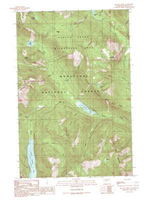
Polallie Ridge Topo Map Washington
To zoom in, hover over the map of Polallie Ridge
USGS Topo Quad 47121d2 - 1:24,000 scale
| Topo Map Name: | Polallie Ridge |
| USGS Topo Quad ID: | 47121d2 |
| Print Size: | ca. 21 1/4" wide x 27" high |
| Southeast Coordinates: | 47.375° N latitude / 121.125° W longitude |
| Map Center Coordinates: | 47.4375° N latitude / 121.1875° W longitude |
| U.S. State: | WA |
| Filename: | o47121d2.jpg |
| Download Map JPG Image: | Polallie Ridge topo map 1:24,000 scale |
| Map Type: | Topographic |
| Topo Series: | 7.5´ |
| Map Scale: | 1:24,000 |
| Source of Map Images: | United States Geological Survey (USGS) |
| Alternate Map Versions: |
Polallie Ridge WA 1989, updated 1989 Download PDF Buy paper map Polallie Ridge WA 1989, updated 1989 Download PDF Buy paper map Polallie Ridge WA 2003, updated 2006 Download PDF Buy paper map Polallie Ridge WA 2011 Download PDF Buy paper map Polallie Ridge WA 2014 Download PDF Buy paper map |
| FStopo: | US Forest Service topo Polallie Ridge is available: Download FStopo PDF Download FStopo TIF |
1:24,000 Topo Quads surrounding Polallie Ridge
> Back to 47121a1 at 1:100,000 scale
> Back to 47120a1 at 1:250,000 scale
> Back to U.S. Topo Maps home
Polallie Ridge topo map: Gazetteer
Polallie Ridge: Gaps
Copper Pass elevation 1009m 3310′Waptus Pass elevation 1317m 4320′
Polallie Ridge: Lakes
Cooper Lake elevation 851m 2791′Diamond Lake elevation 1509m 4950′
Escondido Lake elevation 1411m 4629′
Little Joe Lake elevation 1437m 4714′
Little Kachess Lake elevation 688m 2257′
Pete Lake elevation 910m 2985′
Polallie Ridge: Ridges
No Name Ridge elevation 1575m 5167′Polallie Ridge elevation 1533m 5029′
Polallie Ridge: Streams
Delate Creek elevation 863m 2831′Goat Creek elevation 877m 2877′
Lemah Creek elevation 878m 2880′
Mineral Creek elevation 729m 2391′
No Name Creek elevation 690m 2263′
Quick Creek elevation 917m 3008′
Spinola Creek elevation 907m 2975′
State Creek elevation 851m 2791′
Tired Creek elevation 854m 2801′
Trail Creek elevation 920m 3018′
Tumble Creek elevation 872m 2860′
Polallie Ridge: Summits
Cone Mountain elevation 1596m 5236′Island Mountain elevation 1332m 4370′
Red Mountain elevation 1724m 5656′
Polallie Ridge: Trails
Cooper Pass Trail elevation 750m 2460′Escondido Trail elevation 1284m 4212′
Waptus Pass Trail elevation 1215m 3986′
Polallie Ridge digital topo map on disk
Buy this Polallie Ridge topo map showing relief, roads, GPS coordinates and other geographical features, as a high-resolution digital map file on DVD:


