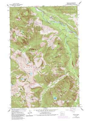
Grotto Topo Map Washington
To zoom in, hover over the map of Grotto
USGS Topo Quad 47121f4 - 1:24,000 scale
| Topo Map Name: | Grotto |
| USGS Topo Quad ID: | 47121f4 |
| Print Size: | ca. 21 1/4" wide x 27" high |
| Southeast Coordinates: | 47.625° N latitude / 121.375° W longitude |
| Map Center Coordinates: | 47.6875° N latitude / 121.4375° W longitude |
| U.S. State: | WA |
| Filename: | o47121f4.jpg |
| Download Map JPG Image: | Grotto topo map 1:24,000 scale |
| Map Type: | Topographic |
| Topo Series: | 7.5´ |
| Map Scale: | 1:24,000 |
| Source of Map Images: | United States Geological Survey (USGS) |
| Alternate Map Versions: |
Grotto WA 1965, updated 1967 Download PDF Buy paper map Grotto WA 1965, updated 1973 Download PDF Buy paper map Grotto WA 1965, updated 1982 Download PDF Buy paper map Grotto WA 1965, updated 1991 Download PDF Buy paper map Grotto WA 2011 Download PDF Buy paper map Grotto WA 2014 Download PDF Buy paper map |
| FStopo: | US Forest Service topo Grotto is available: Download FStopo PDF Download FStopo TIF |
1:24,000 Topo Quads surrounding Grotto
> Back to 47121e1 at 1:100,000 scale
> Back to 47120a1 at 1:250,000 scale
> Back to U.S. Topo Maps home
Grotto topo map: Gazetteer
Grotto: Basins
Goat Basin elevation 1068m 3503′Grotto: Lakes
Bear Lakes elevation 1452m 4763′Boner Lake elevation 1473m 4832′
Cement Lake elevation 1252m 4107′
Cleveland Lake elevation 1216m 3989′
Coney Lake elevation 1574m 5164′
Crosby Lake elevation 1375m 4511′
Crystal Lake elevation 1060m 3477′
Francis Lake elevation 1309m 4294′
Lake Kanim elevation 1202m 3943′
Lennox Lake elevation 1434m 4704′
Tumwater Lake elevation 1128m 3700′
Grotto: Mines
Cleopatra Mine elevation 1042m 3418′Grotto: Populated Places
Grotto elevation 272m 892′Miller River elevation 278m 912′
Grotto: Streams
Coney Creek elevation 623m 2043′East Fork Miller River elevation 363m 1190′
Engle Creek elevation 367m 1204′
Goat Creek elevation 570m 1870′
Great Falls Creek elevation 504m 1653′
Kimball Creek elevation 381m 1250′
Lowe Creek elevation 251m 823′
Miller River elevation 267m 875′
Money Creek elevation 256m 839′
West Fork Miller River elevation 360m 1181′
Grotto: Summits
Cleveland Mountain elevation 1589m 5213′Crosby Mountain elevation 1678m 5505′
Lennox Mountain elevation 1789m 5869′
Palmer Mountain elevation 1464m 4803′
Temple Mountain elevation 1033m 3389′
Grotto: Tunnels
Tunnel on US 2 elevation 301m 987′Grotto digital topo map on disk
Buy this Grotto topo map showing relief, roads, GPS coordinates and other geographical features, as a high-resolution digital map file on DVD:


