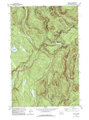
Lake Joy Topo Map Washington
To zoom in, hover over the map of Lake Joy
USGS Topo Quad 47121f7 - 1:24,000 scale
| Topo Map Name: | Lake Joy |
| USGS Topo Quad ID: | 47121f7 |
| Print Size: | ca. 21 1/4" wide x 27" high |
| Southeast Coordinates: | 47.625° N latitude / 121.75° W longitude |
| Map Center Coordinates: | 47.6875° N latitude / 121.8125° W longitude |
| U.S. State: | WA |
| Filename: | o47121f7.jpg |
| Download Map JPG Image: | Lake Joy topo map 1:24,000 scale |
| Map Type: | Topographic |
| Topo Series: | 7.5´ |
| Map Scale: | 1:24,000 |
| Source of Map Images: | United States Geological Survey (USGS) |
| Alternate Map Versions: |
Lake Joy WA 1953, updated 1955 Download PDF Buy paper map Lake Joy WA 1953, updated 1959 Download PDF Buy paper map Lake Joy WA 1953, updated 1969 Download PDF Buy paper map Lake Joy WA 1953, updated 1991 Download PDF Buy paper map Lake Joy WA 1986, updated 2003 Download PDF Buy paper map Lake Joy WA 1993, updated 1993 Download PDF Buy paper map Lake Joy WA 2011 Download PDF Buy paper map Lake Joy WA 2014 Download PDF Buy paper map |
1:24,000 Topo Quads surrounding Lake Joy
> Back to 47121e1 at 1:100,000 scale
> Back to 47120a1 at 1:250,000 scale
> Back to U.S. Topo Maps home
Lake Joy topo map: Gazetteer
Lake Joy: Basins
Tolt Regulating Basin elevation 229m 751′Lake Joy: Dams
Sawns Mill Pond Dam elevation 149m 488′Tolt River Regulating Basin South Dam elevation 235m 770′
Tolt River Regulating Basin West Dam elevation 269m 882′
Lake Joy: Lakes
Hull Lake elevation 256m 839′Lake Joy elevation 162m 531′
Moss Lake elevation 161m 528′
Todd Lake elevation 195m 639′
Lake Joy: Reservoirs
Swans Mill Pond elevation 149m 488′Tolt River Regulating Basin elevation 269m 882′
Lake Joy: Streams
Beaver Creek elevation 235m 770′Canyon Creek elevation 271m 889′
East Fork Griffin Creek elevation 153m 501′
North Fork Creek elevation 180m 590′
North Fork Tolt River elevation 111m 364′
South Fork Tolt River elevation 111m 364′
Stossel Creek elevation 105m 344′
Yellow Creek elevation 317m 1040′
Lake Joy digital topo map on disk
Buy this Lake Joy topo map showing relief, roads, GPS coordinates and other geographical features, as a high-resolution digital map file on DVD:


