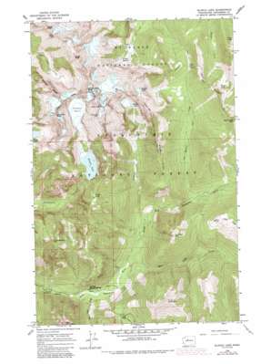
Blanca Lake Topo Map Washington
To zoom in, hover over the map of Blanca Lake
USGS Topo Quad 47121h3 - 1:24,000 scale
| Topo Map Name: | Blanca Lake |
| USGS Topo Quad ID: | 47121h3 |
| Print Size: | ca. 21 1/4" wide x 27" high |
| Southeast Coordinates: | 47.875° N latitude / 121.25° W longitude |
| Map Center Coordinates: | 47.9375° N latitude / 121.3125° W longitude |
| U.S. State: | WA |
| Filename: | o47121h3.jpg |
| Download Map JPG Image: | Blanca Lake topo map 1:24,000 scale |
| Map Type: | Topographic |
| Topo Series: | 7.5´ |
| Map Scale: | 1:24,000 |
| Source of Map Images: | United States Geological Survey (USGS) |
| Alternate Map Versions: |
Blanca Lake WA 1965, updated 1972 Download PDF Buy paper map Blanca Lake WA 1965, updated 1982 Download PDF Buy paper map Blanca Lake WA 1965, updated 1988 Download PDF Buy paper map Blanca Lake WA 2011 Download PDF Buy paper map Blanca Lake WA 2014 Download PDF Buy paper map |
| FStopo: | US Forest Service topo Blanca Lake is available: Download FStopo PDF Download FStopo TIF |
1:24,000 Topo Quads surrounding Blanca Lake
> Back to 47121e1 at 1:100,000 scale
> Back to 47120a1 at 1:250,000 scale
> Back to U.S. Topo Maps home
Blanca Lake topo map: Gazetteer
Blanca Lake: Basins
Glacier Basin elevation 1420m 4658′Pride Basin elevation 921m 3021′
Blanca Lake: Gaps
Curry Gap elevation 1211m 3973′Ida Pass elevation 1845m 6053′
Jack Pass elevation 791m 2595′
Blanca Lake: Glaciers
Columbia Glacier elevation 1606m 5269′Blanca Lake: Lakes
Blanca Lake elevation 1212m 3976′Bowser Lake elevation 1486m 4875′
Coney Lake elevation 1301m 4268′
Goblin Lake elevation 1264m 4146′
Quartz Lake elevation 1466m 4809′
Virgin Lake elevation 1395m 4576′
Blanca Lake: Ridges
Mystery Hill (not official) elevation 1358m 4455′Storm Ridge elevation 1445m 4740′
Blanca Lake: Springs
Garland Hot Springs elevation 484m 1587′Blanca Lake: Streams
Goblin Creek elevation 555m 1820′Quartz Creek elevation 748m 2454′
San Juan Creek elevation 471m 1545′
West Cady Creek elevation 511m 1676′
Blanca Lake: Summits
Bald Eagle Mountain elevation 1729m 5672′Cadet Peak elevation 2117m 6945′
Columbia Peak elevation 2175m 7135′
Excelsior Mountain elevation 1461m 4793′
Foggy Peak elevation 2064m 6771′
Frog Mountain elevation 1479m 4852′
Goblin Mountain elevation 1628m 5341′
Kyes Peak elevation 2122m 6961′
Monte Cristo Peak elevation 2140m 7020′
Troublesome Mountain elevation 1651m 5416′
Wilmans Peaks elevation 2080m 6824′
Blanca Lake digital topo map on disk
Buy this Blanca Lake topo map showing relief, roads, GPS coordinates and other geographical features, as a high-resolution digital map file on DVD:


