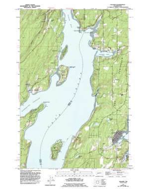
Vaughn Topo Map Washington
To zoom in, hover over the map of Vaughn
USGS Topo Quad 47122c7 - 1:24,000 scale
| Topo Map Name: | Vaughn |
| USGS Topo Quad ID: | 47122c7 |
| Print Size: | ca. 21 1/4" wide x 27" high |
| Southeast Coordinates: | 47.25° N latitude / 122.75° W longitude |
| Map Center Coordinates: | 47.3125° N latitude / 122.8125° W longitude |
| U.S. State: | WA |
| Filename: | o47122c7.jpg |
| Download Map JPG Image: | Vaughn topo map 1:24,000 scale |
| Map Type: | Topographic |
| Topo Series: | 7.5´ |
| Map Scale: | 1:24,000 |
| Source of Map Images: | United States Geological Survey (USGS) |
| Alternate Map Versions: |
Vaughn WA 1953, updated 1954 Download PDF Buy paper map Vaughn WA 1953, updated 1969 Download PDF Buy paper map Vaughn WA 1953, updated 1991 Download PDF Buy paper map Vaughn WA 1953, updated 1994 Download PDF Buy paper map Vaughn WA 1990, updated 2003 Download PDF Buy paper map Vaughn WA 2011 Download PDF Buy paper map Vaughn WA 2014 Download PDF Buy paper map |
1:24,000 Topo Quads surrounding Vaughn
> Back to 47122a1 at 1:100,000 scale
> Back to 47122a1 at 1:250,000 scale
> Back to U.S. Topo Maps home
Vaughn topo map: Gazetteer
Vaughn: Bays
Case Inlet elevation 0m 0′Dutcher Cove elevation 0m 0′
Indian Cove elevation 0m 0′
McLane Cove elevation 0m 0′
Rocky Bay elevation 3m 9′
Vaughn Bay elevation 0m 0′
Von Geldern Cove elevation 2m 6′
Vaughn: Capes
Dougall Point elevation 0m 0′Key Peninsula elevation 77m 252′
Rocky Point elevation 2m 6′
Vaughn: Cliffs
Windy Bluff elevation 38m 124′Vaughn: Dams
Haleys Dam elevation 2m 6′Vaughn: Islands
Herron Island elevation 34m 111′Reach Island elevation 14m 45′
Stretch Island elevation 33m 108′
Vaughn: Lakes
Catfish Lake elevation 21m 68′Herron Lake elevation 59m 193′
Jackson Lake elevation 61m 200′
Mill Pond elevation 8m 26′
Vaughn: Parks
Stadium elevation 36m 118′Stretch Point State Park elevation 24m 78′
Vaughn: Populated Places
Detroit (historical) elevation 8m 26′Fair Harbor elevation 4m 13′
Grapeview elevation 13m 42′
Herron elevation 11m 36′
Home elevation 32m 104′
Lakebay elevation 13m 42′
Vaughn elevation 9m 29′
Vaughn: Reservoirs
Haleys Lagoon elevation 2m 6′Vaughn: Streams
Rocky Creek elevation 25m 82′Vaughn Creek elevation 3m 9′
Vaughn digital topo map on disk
Buy this Vaughn topo map showing relief, roads, GPS coordinates and other geographical features, as a high-resolution digital map file on DVD:


