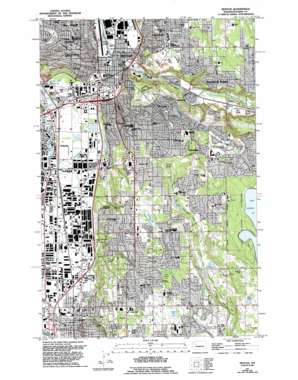
Renton Topo Map Washington
To zoom in, hover over the map of Renton
USGS Topo Quad 47122d2 - 1:24,000 scale
| Topo Map Name: | Renton |
| USGS Topo Quad ID: | 47122d2 |
| Print Size: | ca. 21 1/4" wide x 27" high |
| Southeast Coordinates: | 47.375° N latitude / 122.125° W longitude |
| Map Center Coordinates: | 47.4375° N latitude / 122.1875° W longitude |
| U.S. State: | WA |
| Filename: | o47122d2.jpg |
| Download Map JPG Image: | Renton topo map 1:24,000 scale |
| Map Type: | Topographic |
| Topo Series: | 7.5´ |
| Map Scale: | 1:24,000 |
| Source of Map Images: | United States Geological Survey (USGS) |
| Alternate Map Versions: |
Renton WA 1949, updated 1956 Download PDF Buy paper map Renton WA 1949, updated 1968 Download PDF Buy paper map Renton WA 1949, updated 1969 Download PDF Buy paper map Renton WA 1949, updated 1976 Download PDF Buy paper map Renton WA 1949, updated 1995 Download PDF Buy paper map Renton WA 2011 Download PDF Buy paper map Renton WA 2014 Download PDF Buy paper map |
1:24,000 Topo Quads surrounding Renton
> Back to 47122a1 at 1:100,000 scale
> Back to 47122a1 at 1:250,000 scale
> Back to U.S. Topo Maps home
Renton topo map: Gazetteer
Renton: Airports
Boeing-Renton Ramp Site Nr 2 Heliport elevation 9m 29′Kent Benaroya Heliport elevation 9m 29′
Renton Municipal Airport elevation 8m 26′
Tukwila Operations Center Heliport elevation 9m 29′
Valley Medical Center Heliport elevation 30m 98′
Will Rogers Wiley Post Meml Seaplane Base elevation 11m 36′
Renton: Areas
Renton Watershed elevation 72m 236′Renton: Crossings
Interchange 1 elevation 7m 22′Interchange 2 elevation 9m 29′
Interchange 4A elevation 10m 32′
Interchange 4B elevation 14m 45′
Renton: Lakes
Clark Lake elevation 130m 426′Ham Lake elevation 154m 505′
Kohr Pond elevation 145m 475′
Norkool Pond elevation 121m 396′
Panther Lake elevation 134m 439′
Renton: Mines
Black River Quarry elevation 71m 232′Renton: Parks
Boulevard Lane Park elevation -3m -10′Cascade Park elevation 113m 370′
Cedar River Park elevation 28m 91′
Earlington Park elevation 64m 209′
East Hill Park elevation 120m 393′
Fort Dent Athletic Center elevation 9m 29′
Lake Youngs Park elevation 185m 606′
Phillip Arnold Park elevation 122m 400′
Renton Park elevation 121m 396′
Renton Stadium elevation 9m 29′
Skyway Park elevation 102m 334′
Soos Creek Park elevation 103m 337′
Talbot Hill Park elevation 70m 229′
Tiffany Park elevation 113m 370′
Triangle Park elevation 94m 308′
Windsor Hills Park elevation 62m 203′
Renton: Populated Places
Benson Hill elevation 141m 462′Cascade elevation 140m 459′
East Hill elevation 129m 423′
Elliott elevation 35m 114′
Fairwood elevation 162m 531′
Highlands Park elevation 92m 301′
Kent elevation 13m 42′
Maplewood elevation 19m 62′
Maplewood Heights elevation 111m 364′
O'Brien elevation 9m 29′
Orillia elevation 6m 19′
Renton elevation 12m 39′
Renton: Post Offices
Renton Highlands Station Post Office elevation 117m 383′Renton Post Office elevation 130m 426′
Skyway Post Office elevation 130m 426′
Renton: Springs
Springbrook Springs elevation 72m 236′Renton: Streams
Harrison Creek elevation 33m 108′Madsen Creek elevation 148m 485′
Mill Creek elevation 21m 68′
Molasses Creek elevation 30m 98′
United Nations Creek elevation 104m 341′
Renton digital topo map on disk
Buy this Renton topo map showing relief, roads, GPS coordinates and other geographical features, as a high-resolution digital map file on DVD:


