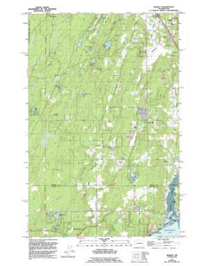
Burley Topo Map Washington
To zoom in, hover over the map of Burley
USGS Topo Quad 47122d6 - 1:24,000 scale
| Topo Map Name: | Burley |
| USGS Topo Quad ID: | 47122d6 |
| Print Size: | ca. 21 1/4" wide x 27" high |
| Southeast Coordinates: | 47.375° N latitude / 122.625° W longitude |
| Map Center Coordinates: | 47.4375° N latitude / 122.6875° W longitude |
| U.S. State: | WA |
| Filename: | o47122d6.jpg |
| Download Map JPG Image: | Burley topo map 1:24,000 scale |
| Map Type: | Topographic |
| Topo Series: | 7.5´ |
| Map Scale: | 1:24,000 |
| Source of Map Images: | United States Geological Survey (USGS) |
| Alternate Map Versions: |
Burley WA 1953, updated 1954 Download PDF Buy paper map Burley WA 1953, updated 1966 Download PDF Buy paper map Burley WA 1953, updated 1969 Download PDF Buy paper map Burley WA 1953, updated 1976 Download PDF Buy paper map Burley WA 1953, updated 1982 Download PDF Buy paper map Burley WA 1953, updated 1994 Download PDF Buy paper map Burley WA 1999, updated 2003 Download PDF Buy paper map Burley WA 2011 Download PDF Buy paper map Burley WA 2014 Download PDF Buy paper map |
1:24,000 Topo Quads surrounding Burley
> Back to 47122a1 at 1:100,000 scale
> Back to 47122a1 at 1:250,000 scale
> Back to U.S. Topo Maps home
Burley topo map: Gazetteer
Burley: Airports
Port Orchard Airport elevation 111m 364′Burley: Dams
Barringer Dam elevation 106m 347′Root Dam elevation 54m 177′
Burley: Lakes
Bear Lake elevation 120m 393′Burley Lagoon elevation 0m 0′
Deep Lake elevation 59m 193′
Doyle Pond elevation 71m 232′
Fairview Lake elevation 115m 377′
Helena Lake elevation 119m 390′
Hidden Lake elevation 116m 380′
Horseshoe Lake elevation 83m 272′
Lake Flora elevation 141m 462′
Matthews Lake elevation 133m 436′
Nels Johnson Lakes elevation 146m 479′
North Lake elevation 125m 410′
Sailor Lake elevation 110m 360′
Square Lake elevation 120m 393′
Stansberry Lake elevation 71m 232′
Wicks Lake elevation 132m 433′
Wildwood Lake elevation 126m 413′
Burley: Populated Places
Bethel elevation 96m 314′Burley elevation 10m 32′
Glenwood elevation 108m 354′
Purdy elevation 7m 22′
Wauna elevation 3m 9′
Wildwood elevation 124m 406′
Burley: Streams
Burley Creek elevation 2m 6′Goodnough Creek elevation 2m 6′
Huge Creek elevation 25m 82′
Purdy Creek elevation 4m 13′
Square Creek elevation 100m 328′
Burley digital topo map on disk
Buy this Burley topo map showing relief, roads, GPS coordinates and other geographical features, as a high-resolution digital map file on DVD:


