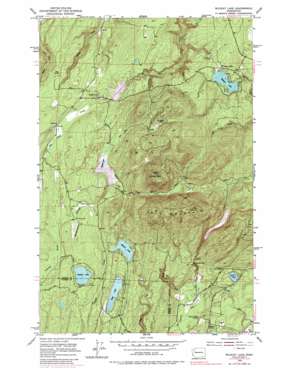
Wildcat Lake Topo Map Washington
To zoom in, hover over the map of Wildcat Lake
USGS Topo Quad 47122e7 - 1:24,000 scale
| Topo Map Name: | Wildcat Lake |
| USGS Topo Quad ID: | 47122e7 |
| Print Size: | ca. 21 1/4" wide x 27" high |
| Southeast Coordinates: | 47.5° N latitude / 122.75° W longitude |
| Map Center Coordinates: | 47.5625° N latitude / 122.8125° W longitude |
| U.S. State: | WA |
| Filename: | o47122e7.jpg |
| Download Map JPG Image: | Wildcat Lake topo map 1:24,000 scale |
| Map Type: | Topographic |
| Topo Series: | 7.5´ |
| Map Scale: | 1:24,000 |
| Source of Map Images: | United States Geological Survey (USGS) |
| Alternate Map Versions: |
Wildcat Lake WA 1953, updated 1955 Download PDF Buy paper map Wildcat Lake WA 1953, updated 1967 Download PDF Buy paper map Wildcat Lake WA 1953, updated 1969 Download PDF Buy paper map Wildcat Lake WA 1953, updated 1981 Download PDF Buy paper map Wildcat Lake WA 1997, updated 2003 Download PDF Buy paper map Wildcat Lake WA 2011 Download PDF Buy paper map Wildcat Lake WA 2014 Download PDF Buy paper map |
1:24,000 Topo Quads surrounding Wildcat Lake
> Back to 47122e1 at 1:100,000 scale
> Back to 47122a1 at 1:250,000 scale
> Back to U.S. Topo Maps home
Wildcat Lake topo map: Gazetteer
Wildcat Lake: Airports
Leisureland Airpark elevation 126m 413′Wildcat Lake: Capes
Great Peninsula elevation 343m 1125′Wildcat Lake: Dams
Casad Dam elevation 183m 600′Lewis Dam elevation 143m 469′
Tahuya River Dam elevation 180m 590′
William Symington Dam elevation 118m 387′
Wildcat Lake: Falls
McKenna Falls elevation 130m 426′Wildcat Lake: Lakes
Mission Lake elevation 159m 521′Panther Lake elevation 153m 501′
Sprague Pond elevation 136m 446′
Tiger Lake elevation 153m 501′
Tin Mine Lake elevation 270m 885′
Twin Lakes elevation 70m 229′
Wildcat Lake elevation 116m 380′
Wildcat Lake: Populated Places
Belfair elevation 89m 291′Crosby elevation 140m 459′
Hite Center elevation 132m 433′
Wildcat Lake elevation 131m 429′
Wildcat Lake: Reservoirs
Lake William Symington elevation 118m 387′Tahuya Lake elevation 180m 590′
Union River Reservoir elevation 183m 600′
Wildcat Lake: Streams
East Fork Union River elevation 46m 150′Gold Creek elevation 181m 593′
Hazel Creek elevation 57m 187′
Panther Creek elevation 142m 465′
Stavis Creek elevation 5m 16′
Tin Mine Creek elevation 181m 593′
Wildcat Lake: Summits
Gold Mountain elevation 528m 1732′Green Mountain elevation 484m 1587′
Wildcat Lake: Swamps
McCaslin Marsh elevation 161m 528′Wildcat Lake digital topo map on disk
Buy this Wildcat Lake topo map showing relief, roads, GPS coordinates and other geographical features, as a high-resolution digital map file on DVD:


