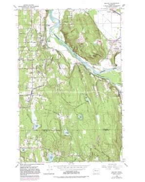
Maltby Topo Map Washington
To zoom in, hover over the map of Maltby
USGS Topo Quad 47122g1 - 1:24,000 scale
| Topo Map Name: | Maltby |
| USGS Topo Quad ID: | 47122g1 |
| Print Size: | ca. 21 1/4" wide x 27" high |
| Southeast Coordinates: | 47.75° N latitude / 122° W longitude |
| Map Center Coordinates: | 47.8125° N latitude / 122.0625° W longitude |
| U.S. State: | WA |
| Filename: | o47122g1.jpg |
| Download Map JPG Image: | Maltby topo map 1:24,000 scale |
| Map Type: | Topographic |
| Topo Series: | 7.5´ |
| Map Scale: | 1:24,000 |
| Source of Map Images: | United States Geological Survey (USGS) |
| Alternate Map Versions: |
Maltby WA 1953, updated 1955 Download PDF Buy paper map Maltby WA 1953, updated 1963 Download PDF Buy paper map Maltby WA 1953, updated 1969 Download PDF Buy paper map Maltby WA 1953, updated 1976 Download PDF Buy paper map Maltby WA 1953, updated 1981 Download PDF Buy paper map Maltby WA 2011 Download PDF Buy paper map Maltby WA 2014 Download PDF Buy paper map |
1:24,000 Topo Quads surrounding Maltby
> Back to 47122e1 at 1:100,000 scale
> Back to 47122a1 at 1:250,000 scale
> Back to U.S. Topo Maps home
Maltby topo map: Gazetteer
Maltby: Bridges
High Bridge elevation 6m 19′Maltby: Cliffs
Fiddlers Bluff elevation 25m 82′Maltby: Dams
Builders Dam elevation 94m 308′Burns Dam elevation 80m 262′
Cathcart Sanitary Landfill Dam elevation 63m 206′
Crystal Lake Dam elevation 101m 331′
Tuck Lake Dam elevation 123m 403′
Maltby: Lakes
Cottage Lake elevation 72m 236′Crescent Lake elevation 9m 29′
Devils Lake elevation 137m 449′
Echo Lake elevation 147m 482′
Lake Beecher elevation 5m 16′
Lake Leota elevation 102m 334′
Little Lake elevation 103m 337′
Paradise Lake elevation 79m 259′
Shadow Lake elevation 4m 13′
Maltby: Populated Places
Cathcart elevation 70m 229′Echo Lake elevation 165m 541′
Fryelands elevation 10m 32′
Maltby elevation 122m 400′
Woodruff elevation 10m 32′
Maltby: Reservoirs
Cathcart Sanitary Landfill Holding Reservoir elevation 63m 206′Crystal Lake elevation 101m 331′
Tuck Lake elevation 123m 403′
Maltby: Streams
Anderson Creek elevation 13m 42′Daniels Creek elevation 72m 236′
Elliott Creek elevation 24m 78′
Evans Creek elevation 9m 29′
Freeman Creek elevation 72m 236′
Ricci Creek elevation 7m 22′
Riley Slough elevation 10m 32′
Skykomish River elevation 5m 16′
Snoqualmie River elevation 5m 16′
Maltby: Summits
Bald Hill elevation 216m 708′Devils Butte elevation 174m 570′
Mount Forest elevation 174m 570′
Ring Hill elevation 179m 587′
Maltby: Valleys
Paradise Valley elevation 80m 262′Maltby digital topo map on disk
Buy this Maltby topo map showing relief, roads, GPS coordinates and other geographical features, as a high-resolution digital map file on DVD:


