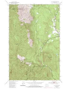
Mount Walker Topo Map Washington
To zoom in, hover over the map of Mount Walker
USGS Topo Quad 47122g8 - 1:24,000 scale
| Topo Map Name: | Mount Walker |
| USGS Topo Quad ID: | 47122g8 |
| Print Size: | ca. 21 1/4" wide x 27" high |
| Southeast Coordinates: | 47.75° N latitude / 122.875° W longitude |
| Map Center Coordinates: | 47.8125° N latitude / 122.9375° W longitude |
| U.S. State: | WA |
| Filename: | o47122g8.jpg |
| Download Map JPG Image: | Mount Walker topo map 1:24,000 scale |
| Map Type: | Topographic |
| Topo Series: | 7.5´ |
| Map Scale: | 1:24,000 |
| Source of Map Images: | United States Geological Survey (USGS) |
| Alternate Map Versions: |
Mt. Walker WA 1953, updated 1955 Download PDF Buy paper map Mt. Walker WA 1953, updated 1970 Download PDF Buy paper map Mt. Walker WA 1953, updated 1975 Download PDF Buy paper map Mt. Walker WA 1953, updated 1986 Download PDF Buy paper map Mount Walker WA 1995, updated 1997 Download PDF Buy paper map Mount Walker WA 2011 Download PDF Buy paper map Mount Walker WA 2014 Download PDF Buy paper map |
| FStopo: | US Forest Service topo Mount Walker is available: Download FStopo PDF Download FStopo TIF |
1:24,000 Topo Quads surrounding Mount Walker
> Back to 47122e1 at 1:100,000 scale
> Back to 47122a1 at 1:250,000 scale
> Back to U.S. Topo Maps home
Mount Walker topo map: Gazetteer
Mount Walker: Cliffs
South Point elevation 822m 2696′Mount Walker: Dams
Big Quilcene Dam elevation 315m 1033′Little Quilcene River Dam elevation 247m 810′
Mount Walker: Gaps
Walker Pass elevation 226m 741′Mount Walker: Lakes
Devils Lake elevation 260m 853′Rice Lake elevation 45m 147′
Mount Walker: Populated Places
Quilcene elevation 12m 39′Mount Walker: Ranges
Quilcene Range elevation 987m 3238′Mount Walker: Streams
Deserter Creek elevation 331m 1085′Elbo Creek elevation 136m 446′
Howe Creek elevation 142m 465′
Leland Creek elevation 31m 101′
Mile and A Half Creek elevation 230m 754′
Penny Creek elevation 36m 118′
Ripley Creek elevation 107m 351′
Threemile Creek elevation 276m 905′
Townsend Creek elevation 445m 1459′
Tunnel Creek elevation 314m 1030′
Mount Walker: Summits
Buck Mountain elevation 1143m 3750′Green Mountain elevation 1340m 4396′
Mount Crag elevation 1315m 4314′
Mount Walker elevation 844m 2769′
Mount Walker digital topo map on disk
Buy this Mount Walker topo map showing relief, roads, GPS coordinates and other geographical features, as a high-resolution digital map file on DVD:


