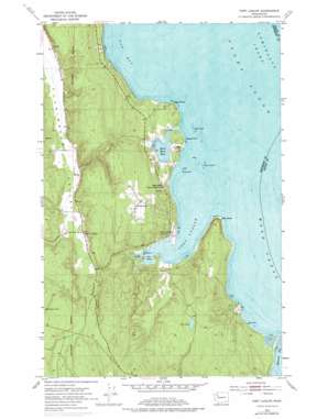
Port Ludlow Topo Map Washington
To zoom in, hover over the map of Port Ludlow
USGS Topo Quad 47122h6 - 1:24,000 scale
| Topo Map Name: | Port Ludlow |
| USGS Topo Quad ID: | 47122h6 |
| Print Size: | ca. 21 1/4" wide x 27" high |
| Southeast Coordinates: | 47.875° N latitude / 122.625° W longitude |
| Map Center Coordinates: | 47.9375° N latitude / 122.6875° W longitude |
| U.S. State: | WA |
| Filename: | o47122h6.jpg |
| Download Map JPG Image: | Port Ludlow topo map 1:24,000 scale |
| Map Type: | Topographic |
| Topo Series: | 7.5´ |
| Map Scale: | 1:24,000 |
| Source of Map Images: | United States Geological Survey (USGS) |
| Alternate Map Versions: |
Port Ludlow WA 1953, updated 1955 Download PDF Buy paper map Port Ludlow WA 1953, updated 1974 Download PDF Buy paper map Port Ludlow WA 1953, updated 1976 Download PDF Buy paper map Port Ludlow WA 2011 Download PDF Buy paper map Port Ludlow WA 2014 Download PDF Buy paper map |
1:24,000 Topo Quads surrounding Port Ludlow
> Back to 47122e1 at 1:100,000 scale
> Back to 47122a1 at 1:250,000 scale
> Back to U.S. Topo Maps home
Port Ludlow topo map: Gazetteer
Port Ludlow: Bars
Colvos Rocks elevation 0m 0′Klas Rock elevation 0m 0′
Snake Rock elevation -20m -66′
Port Ludlow: Bays
Bywater Bay elevation 0m 0′Mats Mats Bay elevation 0m 0′
Oak Bay elevation 0m 0′
Port Ludlow elevation 1m 3′
Port Ludlow: Capes
Basalt Point elevation 0m 0′Bulls Head elevation 10m 32′
Burner Point elevation 20m 65′
Olele Point elevation 1m 3′
Tala Point elevation 1m 3′
Port Ludlow: Dams
Hansen Dam elevation 30m 98′Witter Dam elevation 54m 177′
Port Ludlow: Islands
The Twins elevation 2m 6′Port Ludlow: Lakes
Teal Lake elevation 127m 416′Port Ludlow: Mines
Mats Mats Quarry elevation 5m 16′Port Ludlow: Pillars
White Rock elevation 6m 19′Port Ludlow: Populated Places
Beaver Valley elevation 62m 203′Mats Mats elevation 36m 118′
Port Ludlow elevation 19m 62′
Swansonville elevation 117m 383′
Port Ludlow: Post Offices
Port Ludlow Post Office elevation 36m 118′Port Ludlow digital topo map on disk
Buy this Port Ludlow topo map showing relief, roads, GPS coordinates and other geographical features, as a high-resolution digital map file on DVD:


