Summit Lake Topo Map Washington
To zoom in, hover over the map of Summit Lake
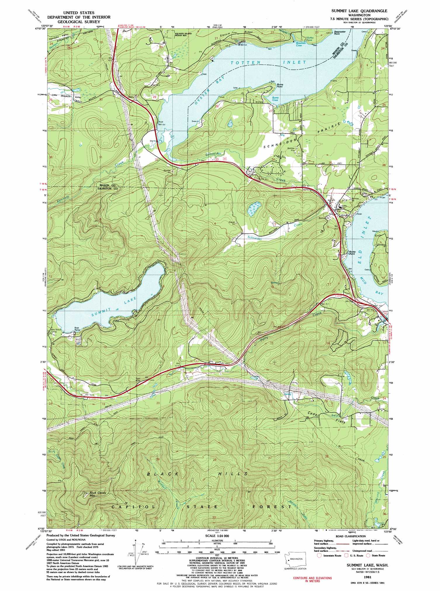
USGS Topo Quad 47123a1 - 1:24,000 scale
| Topo Map Name: | Summit Lake |
| USGS Topo Quad ID: | 47123a1 |
| Print Size: | ca. 21 1/4" wide x 27" high |
| Southeast Coordinates: | 47° N latitude / 123° W longitude |
| Map Center Coordinates: | 47.0625° N latitude / 123.0625° W longitude |
| U.S. State: | WA |
| Filename: | o47123a1.jpg |
| Download Map JPG Image: | Summit Lake topo map 1:24,000 scale |
| Map Type: | Topographic |
| Topo Series: | 7.5´ |
| Map Scale: | 1:24,000 |
| Source of Map Images: | United States Geological Survey (USGS) |
| Alternate Map Versions: |
Summit Lake WA 1981, updated 1982 Download PDF Buy paper map Summit Lake WA 1981, updated 1982 Download PDF Buy paper map Summit Lake WA 2011 Download PDF Buy paper map Summit Lake WA 2014 Download PDF Buy paper map |
1:24,000 Topo Quads surrounding Summit Lake
Vance Creek |
Skokomish Valley |
Union |
Mason Lake |
Vaughn |
Nahwatzel Lake |
Shelton Valley |
Shelton |
Squaxin Island |
Longbranch |
Mccleary |
Kamilche Valley |
Summit Lake |
Olympia |
Lacey |
Malone |
Capitol Peak |
Little Rock |
Maytown |
East Olympia |
Cedarville |
Oakville |
Rochester |
Violet Prairie |
Bucoda |
> Back to 47123a1 at 1:100,000 scale
> Back to 47122a1 at 1:250,000 scale
> Back to U.S. Topo Maps home
Summit Lake topo map: Gazetteer
Summit Lake: Bays
Bowman Cove elevation 3m 9′Burns Cove elevation 0m 0′
Hurley cove elevation 6m 19′
Oyster Bay elevation 1m 3′
Summit Lake: Capes
Burns Point elevation 0m 0′Deepwater Point elevation 20m 65′
Rocky Point elevation 12m 39′
Summit Lake: Dams
Summit Lake Dam elevation 141m 462′Summit Lake: Flats
Cedar Flats elevation 80m 262′Schneider Prairie elevation 40m 131′
Summit Lake: Populated Places
Madrona Beach elevation 12m 39′New Kamilche elevation 64m 209′
Schneiders Prairie elevation 51m 167′
Summit Lake: Reservoirs
Summit Lake elevation 140m 459′Summit Lake: Ridges
Slocum Ridge elevation 81m 265′Summit Lake: Streams
Kennedy Creek elevation 9m 29′Perry Creek elevation 1m 3′
Schneider Creek elevation 9m 29′
Snodgrass Creek elevation 4m 13′
Swift Creek elevation 100m 328′
Summit Lake: Summits
Rock Candy Mountain elevation 709m 2326′Summit Lake: Valleys
Kamilche Valley elevation 14m 45′Summit Lake digital topo map on disk
Buy this Summit Lake topo map showing relief, roads, GPS coordinates and other geographical features, as a high-resolution digital map file on DVD: