Wynoochee Valley Sw Topo Map Washington
To zoom in, hover over the map of Wynoochee Valley Sw
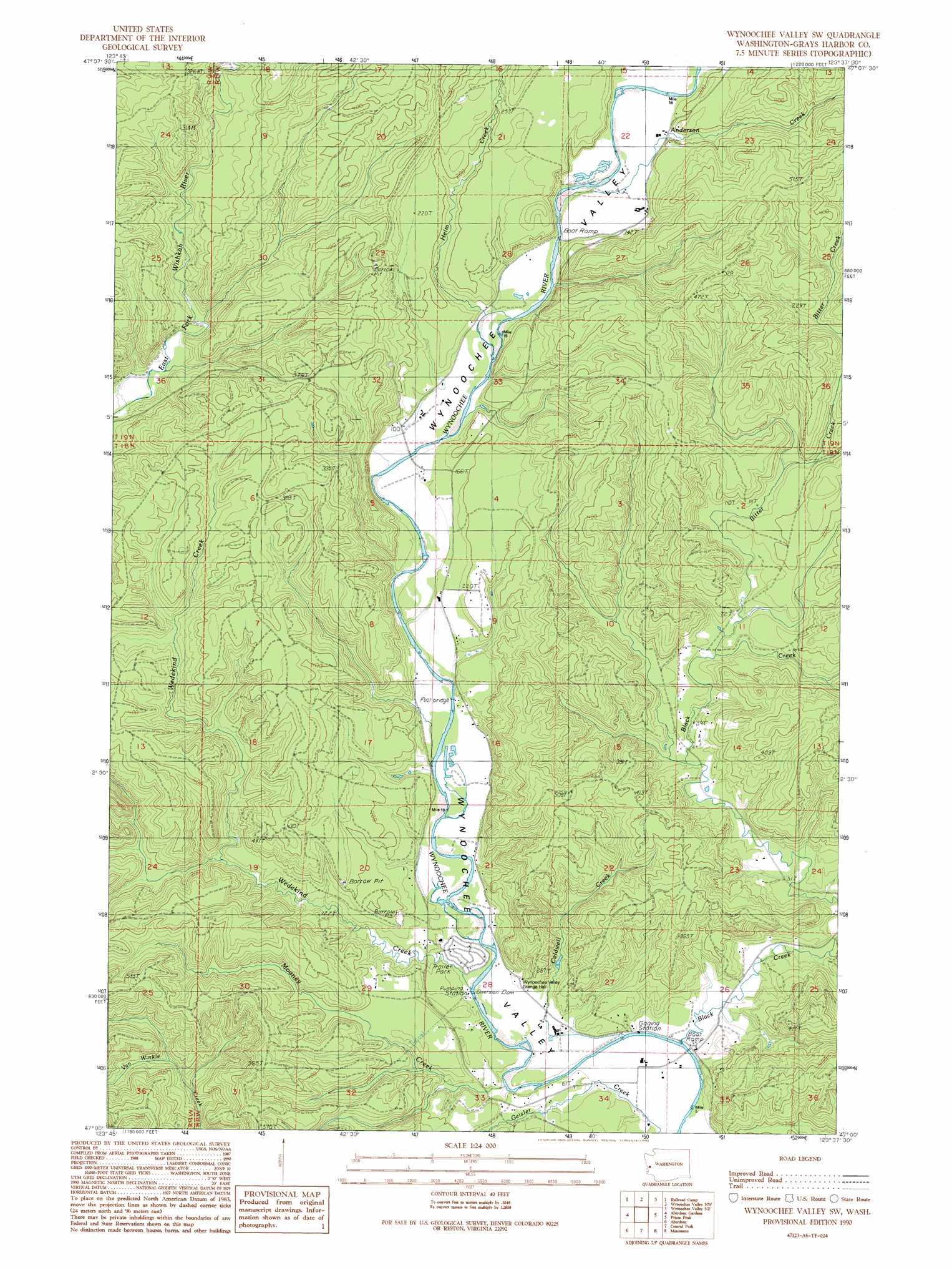
USGS Topo Quad 47123a6 - 1:24,000 scale
| Topo Map Name: | Wynoochee Valley Sw |
| USGS Topo Quad ID: | 47123a6 |
| Print Size: | ca. 21 1/4" wide x 27" high |
| Southeast Coordinates: | 47° N latitude / 123.625° W longitude |
| Map Center Coordinates: | 47.0625° N latitude / 123.6875° W longitude |
| U.S. State: | WA |
| Filename: | o47123a6.jpg |
| Download Map JPG Image: | Wynoochee Valley Sw topo map 1:24,000 scale |
| Map Type: | Topographic |
| Topo Series: | 7.5´ |
| Map Scale: | 1:24,000 |
| Source of Map Images: | United States Geological Survey (USGS) |
| Alternate Map Versions: |
Wynoochee Valley SW WA 1990, updated 1990 Download PDF Buy paper map Wynoochee Valley SW WA 2011 Download PDF Buy paper map Wynoochee Valley SW WA 2014 Download PDF Buy paper map |
1:24,000 Topo Quads surrounding Wynoochee Valley Sw
Stevens Creek |
Burnt Hill |
Larsen Creek |
Grisdale |
Dry Bed Lakes |
Humptulips |
Railroad Camp |
Wynoochee Valley Nw |
Wynoochee Valley Ne |
Matlock |
New London |
Aberdeen Gardens |
Wynoochee Valley Sw |
Prices Peak |
Elma |
Hoquiam |
Aberdeen |
Central Park |
Montesano |
South Elma |
Western |
Aberdeen Se |
Elkhorn Creek |
Brooklyn |
Blue Mountain |
> Back to 47123a1 at 1:100,000 scale
> Back to 47122a1 at 1:250,000 scale
> Back to U.S. Topo Maps home
Wynoochee Valley Sw topo map: Gazetteer
Wynoochee Valley Sw: Streams
Anderson Creek elevation 36m 118′Bitter Creek elevation 25m 82′
Black Creek elevation 8m 26′
Caldwell Creek elevation 10m 32′
Helm Creek elevation 31m 101′
Mooney Creek elevation 13m 42′
Wedekind Creek elevation 25m 82′
Wynoochee Valley Sw digital topo map on disk
Buy this Wynoochee Valley Sw topo map showing relief, roads, GPS coordinates and other geographical features, as a high-resolution digital map file on DVD: