Shelton Valley Topo Map Washington
To zoom in, hover over the map of Shelton Valley
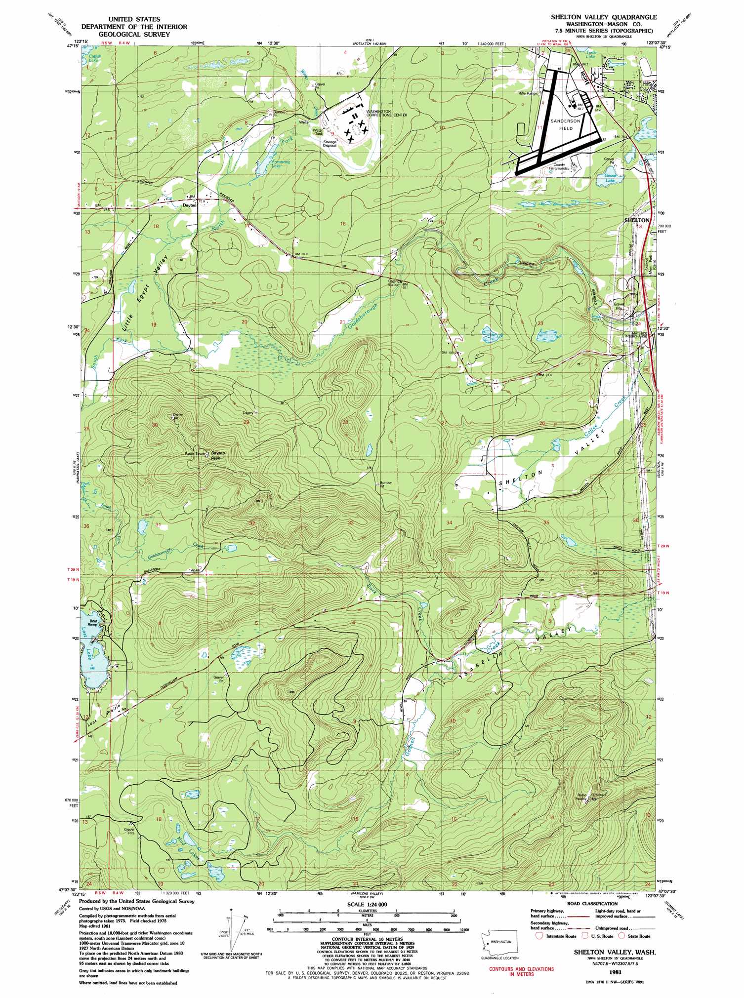
USGS Topo Quad 47123b2 - 1:24,000 scale
| Topo Map Name: | Shelton Valley |
| USGS Topo Quad ID: | 47123b2 |
| Print Size: | ca. 21 1/4" wide x 27" high |
| Southeast Coordinates: | 47.125° N latitude / 123.125° W longitude |
| Map Center Coordinates: | 47.1875° N latitude / 123.1875° W longitude |
| U.S. State: | WA |
| Filename: | o47123b2.jpg |
| Download Map JPG Image: | Shelton Valley topo map 1:24,000 scale |
| Map Type: | Topographic |
| Topo Series: | 7.5´ |
| Map Scale: | 1:24,000 |
| Source of Map Images: | United States Geological Survey (USGS) |
| Alternate Map Versions: |
Shelton Valley WA 2011 Download PDF Buy paper map Shelton Valley WA 2014 Download PDF Buy paper map |
1:24,000 Topo Quads surrounding Shelton Valley
Mount Tebo |
Lightning Peak |
Hoodsport |
Lilliwaup |
Lake Wooten |
Dry Bed Lakes |
Vance Creek |
Skokomish Valley |
Union |
Mason Lake |
Matlock |
Nahwatzel Lake |
Shelton Valley |
Shelton |
Squaxin Island |
Elma |
Mccleary |
Kamilche Valley |
Summit Lake |
Olympia |
South Elma |
Malone |
Capitol Peak |
Little Rock |
Maytown |
> Back to 47123a1 at 1:100,000 scale
> Back to 47122a1 at 1:250,000 scale
> Back to U.S. Topo Maps home
Shelton Valley topo map: Gazetteer
Shelton Valley: Airports
Sanderson Field elevation 82m 269′Shelton Valley: Crossings
Matlock Interchange elevation 25m 82′Shelton Valley: Dams
Uddenberg Dam elevation 77m 252′Shelton Valley: Flats
Lost Prairie elevation 148m 485′Shelton Valley: Lakes
Armstrong Lake elevation 79m 259′Goose Lake elevation 72m 236′
Lost Lake elevation 148m 485′
Mud Lakes elevation 145m 475′
Shelton Valley: Populated Places
Dayton elevation 76m 249′Shelton Valley: Streams
Gosnell Creek elevation 36m 118′North Fork Goldsborough Creek elevation 69m 226′
Rock Creek elevation 54m 177′
South Fork Goldsborough Creek elevation 69m 226′
Winter Creek elevation 82m 269′
Shelton Valley: Summits
Dayton Peak elevation 324m 1062′Shelton Valley: Valleys
Isabella Valley elevation 42m 137′Little Egypt Valley elevation 77m 252′
Shelton Valley elevation 24m 78′
Shelton Valley digital topo map on disk
Buy this Shelton Valley topo map showing relief, roads, GPS coordinates and other geographical features, as a high-resolution digital map file on DVD: