Nahwatzel Lake Topo Map Washington
To zoom in, hover over the map of Nahwatzel Lake
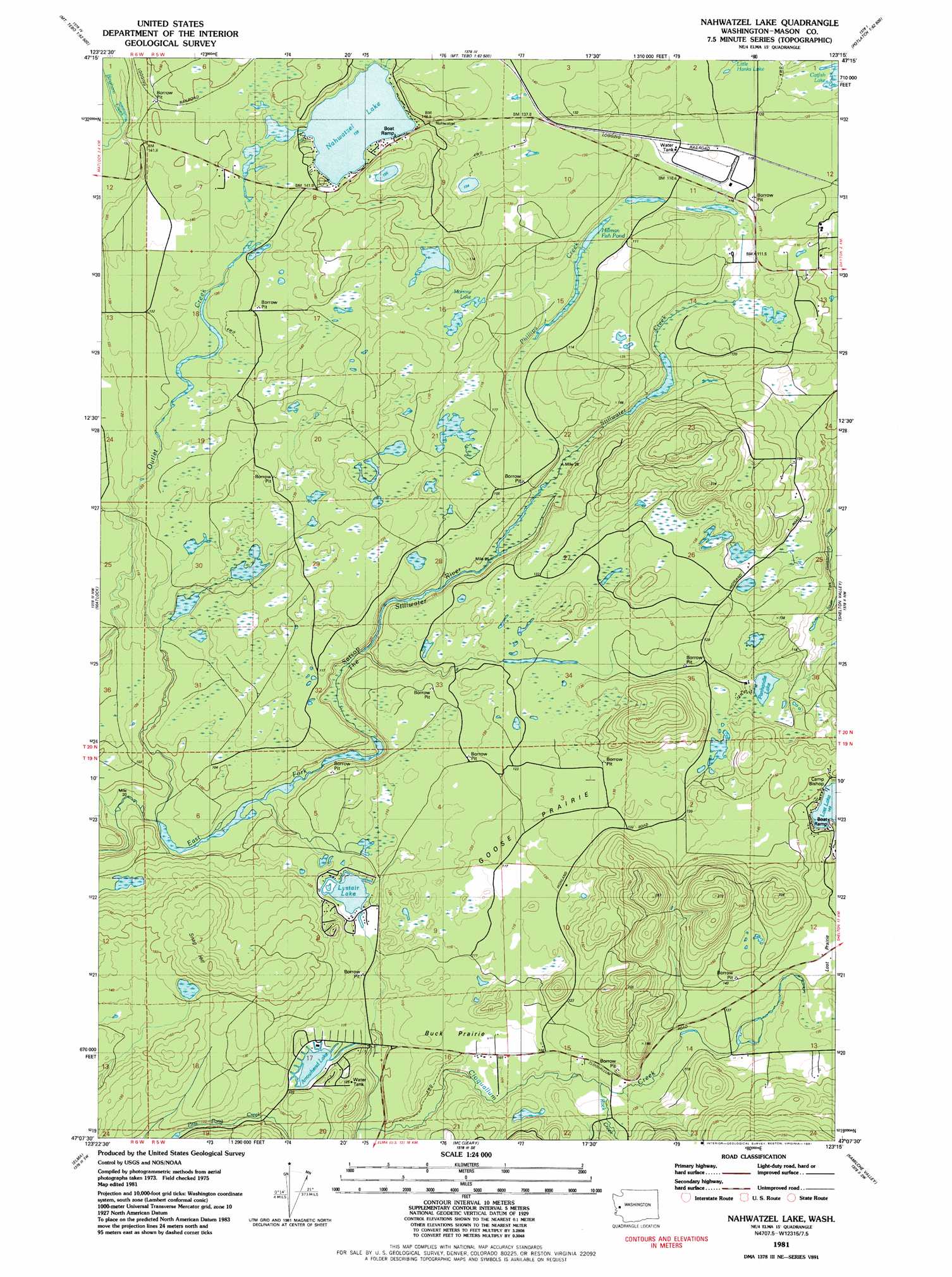
USGS Topo Quad 47123b3 - 1:24,000 scale
| Topo Map Name: | Nahwatzel Lake |
| USGS Topo Quad ID: | 47123b3 |
| Print Size: | ca. 21 1/4" wide x 27" high |
| Southeast Coordinates: | 47.125° N latitude / 123.25° W longitude |
| Map Center Coordinates: | 47.1875° N latitude / 123.3125° W longitude |
| U.S. State: | WA |
| Filename: | o47123b3.jpg |
| Download Map JPG Image: | Nahwatzel Lake topo map 1:24,000 scale |
| Map Type: | Topographic |
| Topo Series: | 7.5´ |
| Map Scale: | 1:24,000 |
| Source of Map Images: | United States Geological Survey (USGS) |
| Alternate Map Versions: |
Nahwatzel Lake WA 1981, updated 1981 Download PDF Buy paper map Nahwatzel Lake WA 2011 Download PDF Buy paper map Nahwatzel Lake WA 2014 Download PDF Buy paper map |
1:24,000 Topo Quads surrounding Nahwatzel Lake
Wynoochee Lake |
Mount Tebo |
Lightning Peak |
Hoodsport |
Lilliwaup |
Grisdale |
Dry Bed Lakes |
Vance Creek |
Skokomish Valley |
Union |
Wynoochee Valley Ne |
Matlock |
Nahwatzel Lake |
Shelton Valley |
Shelton |
Prices Peak |
Elma |
Mccleary |
Kamilche Valley |
Summit Lake |
Montesano |
South Elma |
Malone |
Capitol Peak |
Little Rock |
> Back to 47123a1 at 1:100,000 scale
> Back to 47122a1 at 1:250,000 scale
> Back to U.S. Topo Maps home
Nahwatzel Lake topo map: Gazetteer
Nahwatzel Lake: Flats
Buck Prairie elevation 110m 360′Goose Prairie elevation 119m 390′
Nahwatzel Lake: Lakes
Catfish Lake elevation 119m 390′Hillman Fish Pond elevation 109m 357′
Lake Arrowhead elevation 103m 337′
Lystair Lake elevation 110m 360′
Morrow Lake elevation 118m 387′
Nahwatzel Lake elevation 139m 456′
Panhandle Lake elevation 122m 400′
Nahwatzel Lake: Streams
Phillips Creek elevation 96m 314′Rock Creek elevation 116m 380′
Stillwater Creek elevation 97m 318′
The Stillwater elevation 82m 269′
Nahwatzel Lake: Summits
Snag Hill elevation 196m 643′White Star elevation 250m 820′
Nahwatzel Lake: Swamps
Cranberry Marsh elevation 117m 383′Nahwatzel Lake digital topo map on disk
Buy this Nahwatzel Lake topo map showing relief, roads, GPS coordinates and other geographical features, as a high-resolution digital map file on DVD: