Matlock Topo Map Washington
To zoom in, hover over the map of Matlock
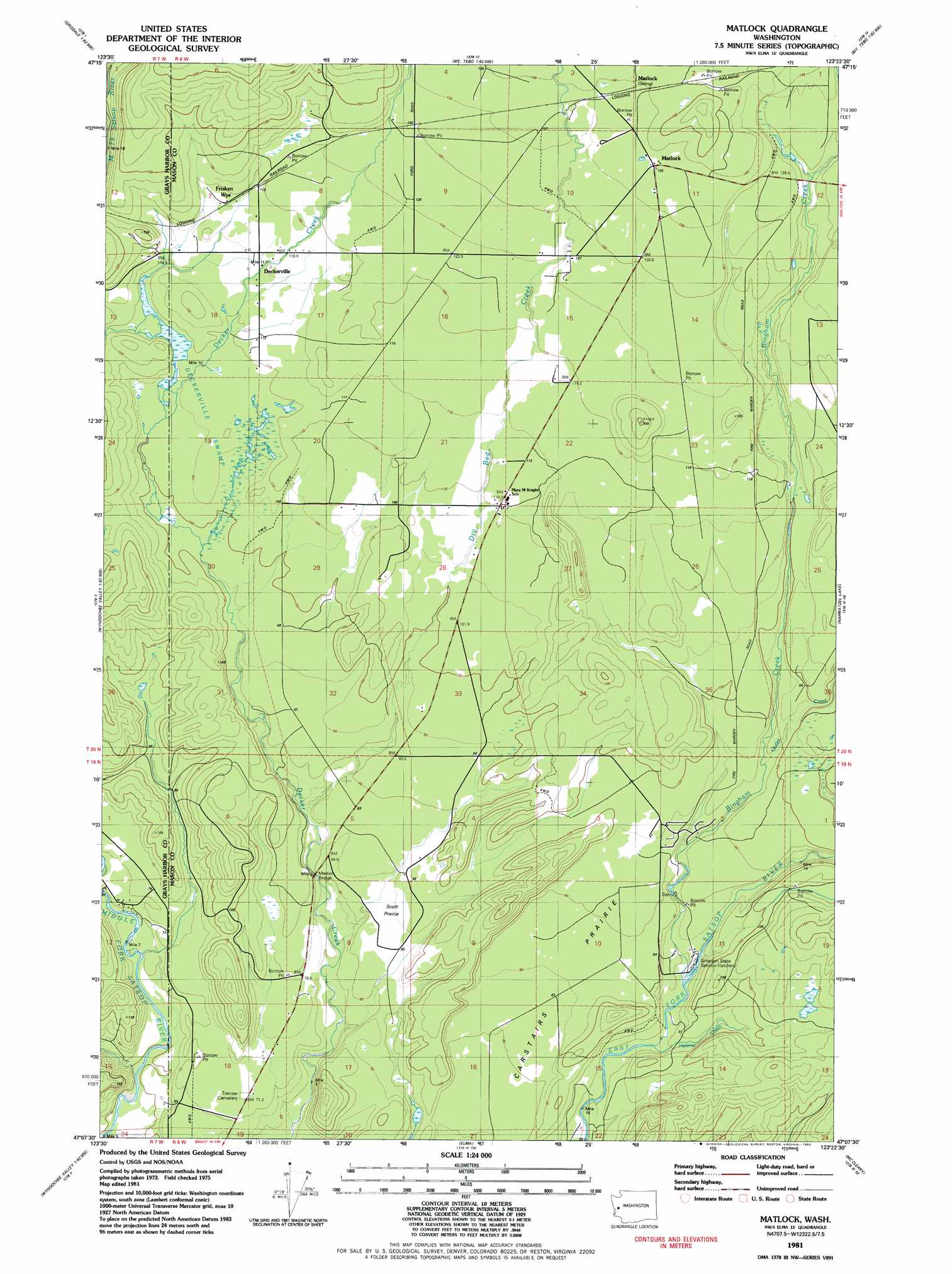
USGS Topo Quad 47123b4 - 1:24,000 scale
| Topo Map Name: | Matlock |
| USGS Topo Quad ID: | 47123b4 |
| Print Size: | ca. 21 1/4" wide x 27" high |
| Southeast Coordinates: | 47.125° N latitude / 123.375° W longitude |
| Map Center Coordinates: | 47.1875° N latitude / 123.4375° W longitude |
| U.S. State: | WA |
| Filename: | o47123b4.jpg |
| Download Map JPG Image: | Matlock topo map 1:24,000 scale |
| Map Type: | Topographic |
| Topo Series: | 7.5´ |
| Map Scale: | 1:24,000 |
| Source of Map Images: | United States Geological Survey (USGS) |
| Alternate Map Versions: |
Matlock WA 1981, updated 1982 Download PDF Buy paper map Matlock WA 2011 Download PDF Buy paper map Matlock WA 2014 Download PDF Buy paper map |
1:24,000 Topo Quads surrounding Matlock
Colonel Bob |
Wynoochee Lake |
Mount Tebo |
Lightning Peak |
Hoodsport |
Larsen Creek |
Grisdale |
Dry Bed Lakes |
Vance Creek |
Skokomish Valley |
Wynoochee Valley Nw |
Wynoochee Valley Ne |
Matlock |
Nahwatzel Lake |
Shelton Valley |
Wynoochee Valley Sw |
Prices Peak |
Elma |
Mccleary |
Kamilche Valley |
Central Park |
Montesano |
South Elma |
Malone |
Capitol Peak |
> Back to 47123a1 at 1:100,000 scale
> Back to 47122a1 at 1:250,000 scale
> Back to U.S. Topo Maps home
Matlock topo map: Gazetteer
Matlock: Areas
Scott Prairie elevation 86m 282′Matlock: Bridges
Martins Bridge elevation 82m 269′Matlock: Flats
Carstairs Prairie elevation 85m 278′Matlock: Populated Places
Deckerville elevation 116m 380′Frisken Wye elevation 116m 380′
Matlock elevation 136m 446′
Matlock: Streams
Bingham Creek elevation 69m 226′Dry Bed Creek elevation 79m 259′
Helene Creek elevation 65m 213′
Outlet Creek elevation 90m 295′
Matlock: Swamps
Deckerville Swamp elevation 105m 344′Matlock: Trails
Bingham Creek Trail elevation 118m 387′Matlock digital topo map on disk
Buy this Matlock topo map showing relief, roads, GPS coordinates and other geographical features, as a high-resolution digital map file on DVD: