Wynoochee Valley Ne Topo Map Washington
To zoom in, hover over the map of Wynoochee Valley Ne
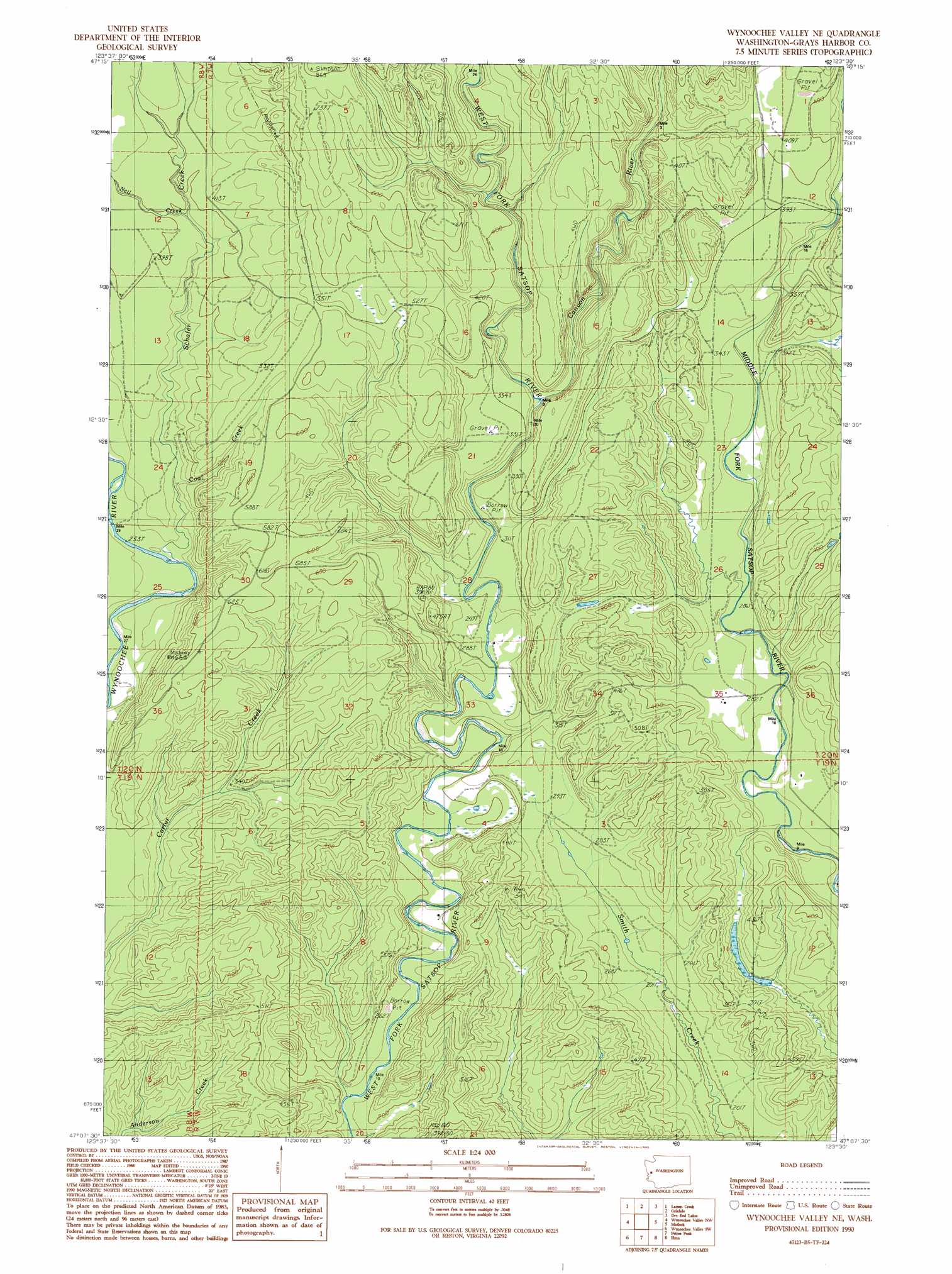
USGS Topo Quad 47123b5 - 1:24,000 scale
| Topo Map Name: | Wynoochee Valley Ne |
| USGS Topo Quad ID: | 47123b5 |
| Print Size: | ca. 21 1/4" wide x 27" high |
| Southeast Coordinates: | 47.125° N latitude / 123.5° W longitude |
| Map Center Coordinates: | 47.1875° N latitude / 123.5625° W longitude |
| U.S. State: | WA |
| Filename: | o47123b5.jpg |
| Download Map JPG Image: | Wynoochee Valley Ne topo map 1:24,000 scale |
| Map Type: | Topographic |
| Topo Series: | 7.5´ |
| Map Scale: | 1:24,000 |
| Source of Map Images: | United States Geological Survey (USGS) |
| Alternate Map Versions: |
Wynoochee Valley NE WA 1990, updated 1990 Download PDF Buy paper map Wynoochee Valley NE WA 2011 Download PDF Buy paper map Wynoochee Valley NE WA 2014 Download PDF Buy paper map |
| FStopo: | US Forest Service topo Wynoochee Valley NE is available: Download FStopo PDF Download FStopo TIF |
1:24,000 Topo Quads surrounding Wynoochee Valley Ne
Quinault Lake East |
Colonel Bob |
Wynoochee Lake |
Mount Tebo |
Lightning Peak |
Burnt Hill |
Larsen Creek |
Grisdale |
Dry Bed Lakes |
Vance Creek |
Railroad Camp |
Wynoochee Valley Nw |
Wynoochee Valley Ne |
Matlock |
Nahwatzel Lake |
Aberdeen Gardens |
Wynoochee Valley Sw |
Prices Peak |
Elma |
Mccleary |
Aberdeen |
Central Park |
Montesano |
South Elma |
Malone |
> Back to 47123a1 at 1:100,000 scale
> Back to 47122a1 at 1:250,000 scale
> Back to U.S. Topo Maps home
Wynoochee Valley Ne topo map: Gazetteer
Wynoochee Valley Ne: Streams
Canyon River elevation 78m 255′Coal Creek elevation 88m 288′
Neil Creek elevation 109m 357′
Schafer Creek elevation 82m 269′
Wynoochee Valley Ne digital topo map on disk
Buy this Wynoochee Valley Ne topo map showing relief, roads, GPS coordinates and other geographical features, as a high-resolution digital map file on DVD: