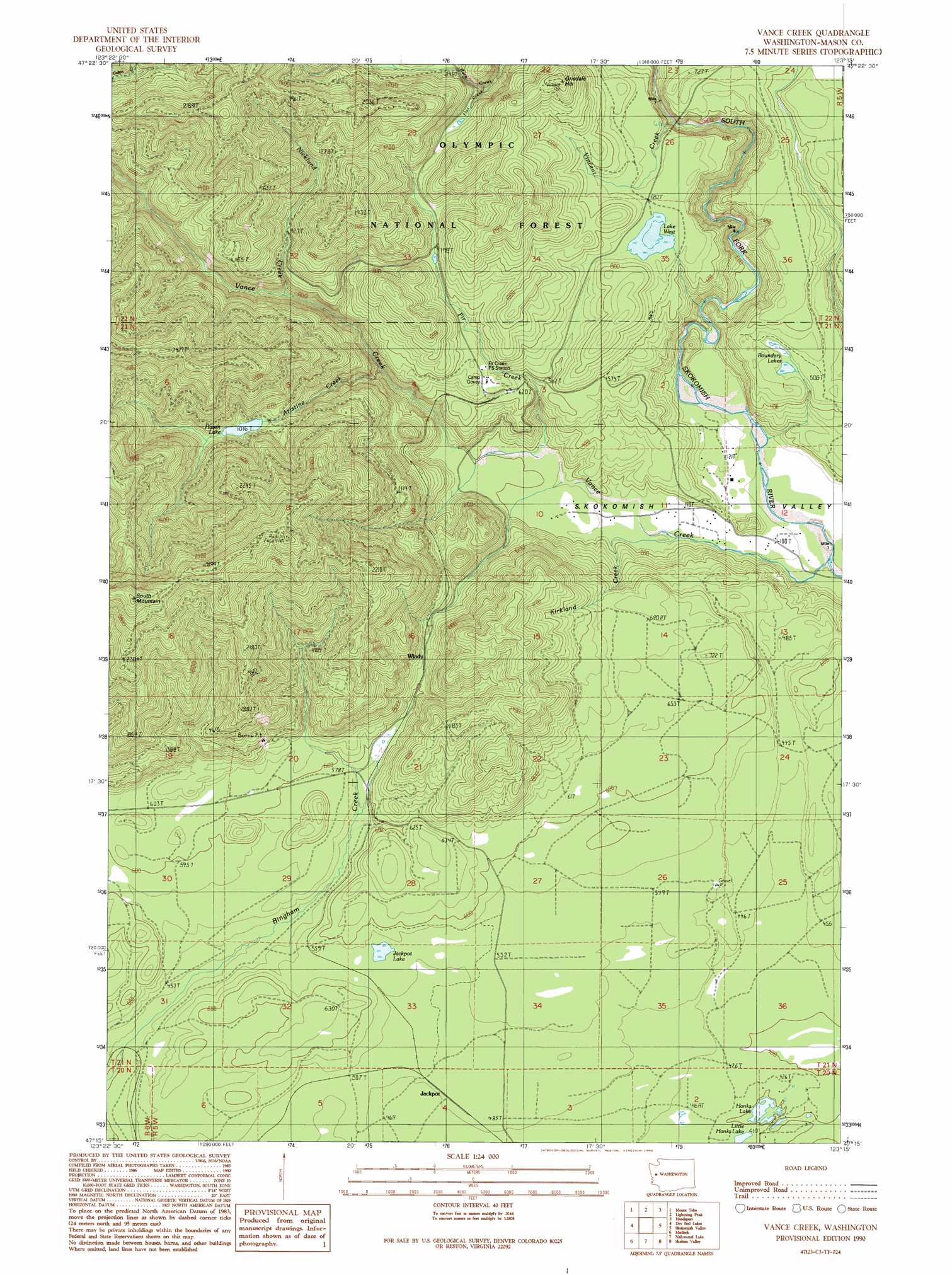
Vance Creek Topo Map Washington
To zoom in, hover over the map of Vance Creek
USGS Topo Quad 47123c3 - 1:24,000 scale
| Topo Map Name: | Vance Creek |
| USGS Topo Quad ID: | 47123c3 |
| Print Size: | ca. 21 1/4" wide x 27" high |
| Southeast Coordinates: | 47.25° N latitude / 123.25° W longitude |
| Map Center Coordinates: | 47.3125° N latitude / 123.3125° W longitude |
| U.S. State: | WA |
| Filename: | o47123c3.jpg |
| Download Map JPG Image: | Vance Creek topo map 1:24,000 scale |
| Map Type: | Topographic |
| Topo Series: | 7.5´ |
| Map Scale: | 1:24,000 |
| Source of Map Images: | United States Geological Survey (USGS) |
| Alternate Map Versions: |
Vance Creek WA 1990, updated 1990 Download PDF Buy paper map Vance Creek WA 2011 Download PDF Buy paper map Vance Creek WA 2014 Download PDF Buy paper map |
| FStopo: | US Forest Service topo Vance Creek is available: Download FStopo PDF Download FStopo TIF |
1:24,000 Topo Quads surrounding Vance Creek
Mount Hoquiam |
Mount Olsen |
Mount Skokomish |
Mount Washington |
Eldon |
Wynoochee Lake |
Mount Tebo |
Lightning Peak |
Hoodsport |
Lilliwaup |
Grisdale |
Dry Bed Lakes |
Vance Creek |
Skokomish Valley |
Union |
Wynoochee Valley Ne |
Matlock |
Nahwatzel Lake |
Shelton Valley |
Shelton |
Prices Peak |
Elma |
Mccleary |
Kamilche Valley |
Summit Lake |
> Back to 47123a1 at 1:100,000 scale
> Back to 47122a1 at 1:250,000 scale
> Back to U.S. Topo Maps home
Vance Creek topo map: Gazetteer
Vance Creek: Dams
West Lake Dam elevation 197m 646′Vance Creek: Lakes
Boundary Lakes elevation 143m 469′Hanks Lake elevation 121m 396′
Haven Lake elevation 311m 1020′
Jackpot Lake elevation 159m 521′
Lake West elevation 197m 646′
Little Hanks Lake elevation 121m 396′
Vance Creek: Reservoirs
West Lake elevation 197m 646′Vance Creek: Streams
Aristine Creek elevation 155m 508′Fir Creek elevation 52m 170′
Flat Creek elevation 198m 649′
Kirkland Creek elevation 32m 104′
Nicklund Creek elevation 161m 528′
Vance Creek elevation 22m 72′
Vincent Creek elevation 133m 436′
Vance Creek: Summits
Grisdale Hill elevation 441m 1446′South Mountain elevation 885m 2903′
Vance Creek digital topo map on disk
Buy this Vance Creek topo map showing relief, roads, GPS coordinates and other geographical features, as a high-resolution digital map file on DVD: