Grisdale Topo Map Washington
To zoom in, hover over the map of Grisdale
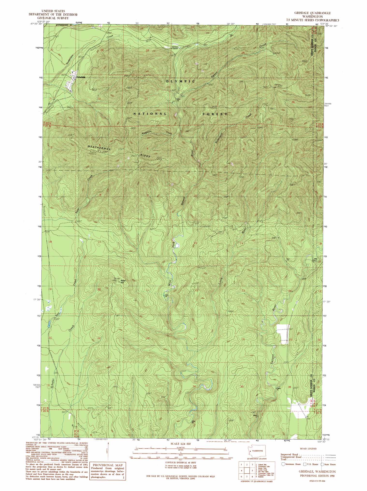
USGS Topo Quad 47123c5 - 1:24,000 scale
| Topo Map Name: | Grisdale |
| USGS Topo Quad ID: | 47123c5 |
| Print Size: | ca. 21 1/4" wide x 27" high |
| Southeast Coordinates: | 47.25° N latitude / 123.5° W longitude |
| Map Center Coordinates: | 47.3125° N latitude / 123.5625° W longitude |
| U.S. State: | WA |
| Filename: | o47123c5.jpg |
| Download Map JPG Image: | Grisdale topo map 1:24,000 scale |
| Map Type: | Topographic |
| Topo Series: | 7.5´ |
| Map Scale: | 1:24,000 |
| Source of Map Images: | United States Geological Survey (USGS) |
| Alternate Map Versions: |
Grisdale WA 1990, updated 1990 Download PDF Buy paper map Grisdale WA 2011 Download PDF Buy paper map Grisdale WA 2014 Download PDF Buy paper map |
| FStopo: | US Forest Service topo Grisdale is available: Download FStopo PDF Download FStopo TIF |
1:24,000 Topo Quads surrounding Grisdale
Finley Creek |
Bunch Lake |
Mount Hoquiam |
Mount Olsen |
Mount Skokomish |
Quinault Lake East |
Colonel Bob |
Wynoochee Lake |
Mount Tebo |
Lightning Peak |
Burnt Hill |
Larsen Creek |
Grisdale |
Dry Bed Lakes |
Vance Creek |
Railroad Camp |
Wynoochee Valley Nw |
Wynoochee Valley Ne |
Matlock |
Nahwatzel Lake |
Aberdeen Gardens |
Wynoochee Valley Sw |
Prices Peak |
Elma |
Mccleary |
> Back to 47123a1 at 1:100,000 scale
> Back to 47122a1 at 1:250,000 scale
> Back to U.S. Topo Maps home
Grisdale topo map: Gazetteer
Grisdale: Populated Places
Grisdale elevation 256m 839′Grisdale: Ridges
Weatherwax Ridge elevation 822m 2696′Grisdale: Streams
Little River elevation 134m 439′Musgrove Creek elevation 271m 889′
Robertson Creek elevation 236m 774′
Spoon Creek elevation 257m 843′
Grisdale: Summits
Reed Hill elevation 440m 1443′Grisdale digital topo map on disk
Buy this Grisdale topo map showing relief, roads, GPS coordinates and other geographical features, as a high-resolution digital map file on DVD: