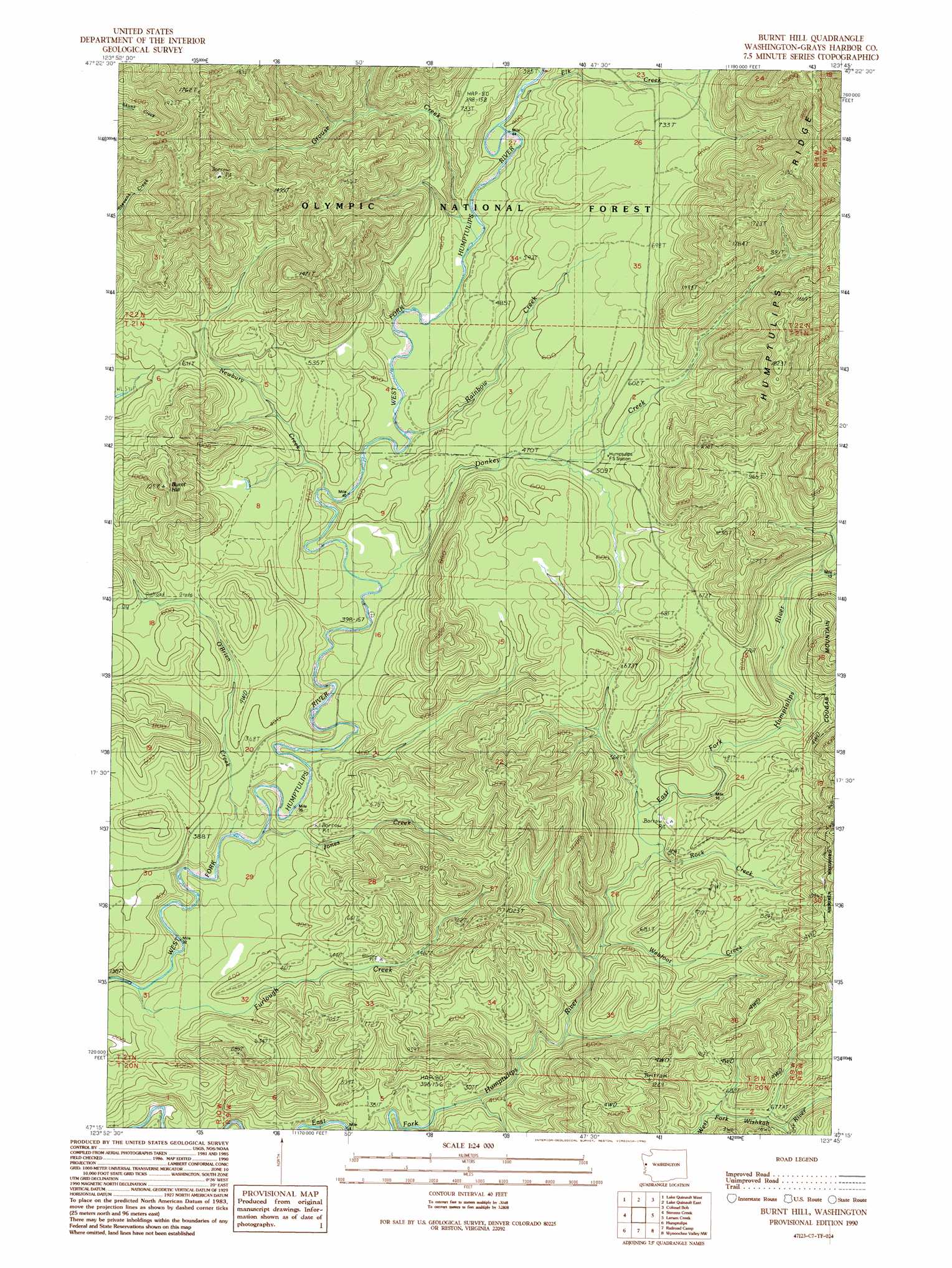
Burnt Hill Topo Map Washington
To zoom in, hover over the map of Burnt Hill
USGS Topo Quad 47123c7 - 1:24,000 scale
| Topo Map Name: | Burnt Hill |
| USGS Topo Quad ID: | 47123c7 |
| Print Size: | ca. 21 1/4" wide x 27" high |
| Southeast Coordinates: | 47.25° N latitude / 123.75° W longitude |
| Map Center Coordinates: | 47.3125° N latitude / 123.8125° W longitude |
| U.S. State: | WA |
| Filename: | o47123c7.jpg |
| Download Map JPG Image: | Burnt Hill topo map 1:24,000 scale |
| Map Type: | Topographic |
| Topo Series: | 7.5´ |
| Map Scale: | 1:24,000 |
| Source of Map Images: | United States Geological Survey (USGS) |
| Alternate Map Versions: |
Burnt Hill WA 1990, updated 1990 Download PDF Buy paper map Burnt Hill WA 2011 Download PDF Buy paper map Burnt Hill WA 2014 Download PDF Buy paper map |
| FStopo: | US Forest Service topo Burnt Hill is available: Download FStopo PDF Download FStopo TIF |
1:24,000 Topo Quads surrounding Burnt Hill
Salmon River East |
Matheny Ridge |
Finley Creek |
Bunch Lake |
Mount Hoquiam |
Thimble Mountain |
Quinault Lake West |
Quinault Lake East |
Colonel Bob |
Wynoochee Lake |
Macafee Hill |
Stevens Creek |
Burnt Hill |
Larsen Creek |
Grisdale |
Carlisle |
Humptulips |
Railroad Camp |
Wynoochee Valley Nw |
Wynoochee Valley Ne |
Copalis Crossing |
New London |
Aberdeen Gardens |
Wynoochee Valley Sw |
Prices Peak |
> Back to 47123a1 at 1:100,000 scale
> Back to 47122a1 at 1:250,000 scale
> Back to U.S. Topo Maps home
Burnt Hill topo map: Gazetteer
Burnt Hill: Streams
Donkey Creek elevation 90m 295′Elk Creek elevation 123m 403′
Furlough Creek elevation 64m 209′
Grouse Creek elevation 108m 354′
Jones Creek elevation 79m 259′
Newbury Creek elevation 103m 337′
O'Brien Creek elevation 74m 242′
Rainbow Creek elevation 99m 324′
Rock Creek elevation 117m 383′
Webfoot Creek elevation 102m 334′
Burnt Hill: Summits
Burnt Hill elevation 347m 1138′Cougar Mountain elevation 449m 1473′
Burnt Hill digital topo map on disk
Buy this Burnt Hill topo map showing relief, roads, GPS coordinates and other geographical features, as a high-resolution digital map file on DVD: